Salute to Ulmer Park, short-lived Brooklyn beer getaway

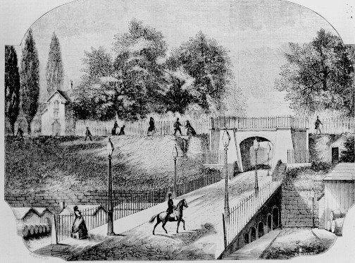
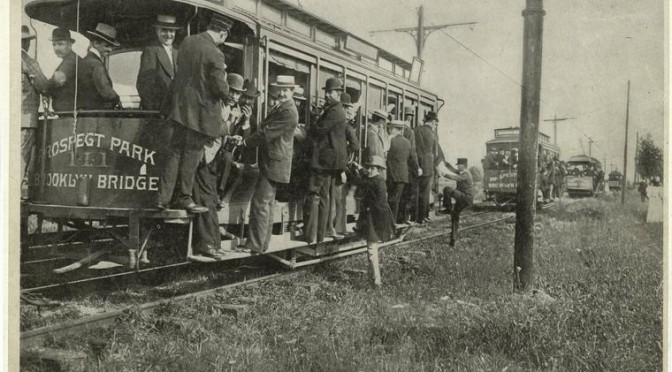
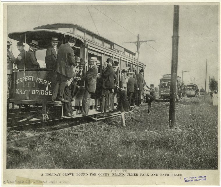
All aboard the train to Coney Island, Ulmer Park and Bath Beach Above pic courtesy NYPL

Next weekend on Coney Island is the annual Siren Festival, sponsored by the Village Voice. Are you going? Believe it or not, over a 100 years ago, there was once a time you could get your beer, music and mayhem at a Brooklyn ‘pleasure park’ just a few stops short of Coney Island — near today’s Bensonhurst neighborhood.

Ulmer Park was the lark of William Ulmer, one of Brooklyn’s most successful brewers in an age where much of the nation’s finest beer was coming from the future borough. The German-born son of a wine merchant who learned the trade from his uncle, Ulmer opened his eponymous brewery in the 1870s at Belvedere Street and soon came upon the idea of opening a park as a way of selling more beer. (Not a bad idea. Jacob Ruppert would have similar designs in mind when he bought the New York Yankees in 1915).

The park would open in 1893 in Gravesend Bay along the southern shore of Brooklyn — back when there was an actual shore — between Coney Island farther south and the more conservative Bath Beach resort community to its west. Ulmer Park seemed to have more in common with Bath Beach — clean, family friendly (keep Dad happy so he keeps drinking!) with a beer garden, carousels and swings, rifle ranges, a dance pavilion and of course plenty of beachfront property.

The park seemed to be particular popular with Germans — Ulmer after all was German, and this was a beer garden — and particularly the annual ‘Saengerfest’ festival. A Times article even claims that 100,000 gathered at Ulmer Park for the end of one such festival.

Below: an illustration of Ulmer Park. Note the grand pier which stuck out into into the bay
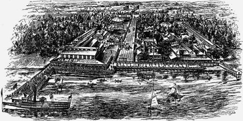
We can get a good idea of Ulmer’s intentions for the park by looking at his failure at obtaining a “liquor tax certificate” (or license) in a report from 1900. “A picnic ground, or open air pleasure resort, of about two acres” between Harway Avenue and the shore, the park had a bowling alley, a pier with canopied bar at the end, two or three other beer pavilions scattered throughout the property and a hotel.

Ultimately, neither the resort at Bath Beach nor amusements at Ulmer Park could compete with Coney Island which was about to enter its golden age in the early 1900s; apparently, it was grit and decadence people wanted in their summertime Brooklyn getaways. Ulmer closed in 1899.

The land remained a public space hosting baseball, cricket and track and field events. Eventually it was wiped away and redeveloped. It remains in name only, at the Ulmer Park branch of the Brooklyn Public Library and the name of the neighborhood bus depot.

For your frame of reference, the park was located a couple blocks west of today’s bus depot, located here:

View Larger Map

FYI, did you know that Central Park and Prospect Park designer Calvert Vaux drowned “under mysterious circumstances” in 1895 and that his body washed up on shore not too far away from Ulmer Park?
Thank you Bob. Thank you Gowanus Lounge.

We’d like to offer our condolences to the friends and family of Robert Guskind, the creator and wit behind Gowanus Lounge, one of the very best blogs about Brooklyn. When I began this site over 20 months ago, Guskind’s was one of the first that I linked to and read on a regular basis, admiring his observations of the culture, history and current events — not only on the quirky, misunderstood neighborhood of Gowanus, but the entire borough. It’s at times tart, always immediate, insightful and questioning.

Thankfully, after a technical glitch, the site is back up and I recommend you flip back to older posts. He had a particularly great ability to find photos of the most unusual corners of his home neighborhood. Flatbush Gardener has a links featuring other tributes to Bob and his work.

Patrick Henry McCarren: how a politican became a pool

Patrick Henry McCarren — best known today for leaving his last name to a park and a swimming pool — was a complicated figure, so it makes sense he should be considered a sort of godfather to a rather complicated neighborhood like Williamsburg.

McCarren became the voice of Greenpoint and Williamsburg at a pivotal time of growth for Brooklyn, during the years of consolidation with New York. He worked his way up and, once there, bought himself favor like a good old-fashioned machine Democrat would — one hand outstretched to the working class, the other in the pocket of big industry.

Born in East Cambridge, Massachusetts of Irish parents in 1847, McCarren headed to Brooklyn and worked first in Williamsburg’s thriving sugar refineries, then as a cooper, and finally as a lawyer, the springboard for his real ambitions in local politics. Civic service was his singular objective, entering Kings County’s democratic machine at age 21. In 1881, he was elected a state senator, a vantage he would use in accumulating great influence.

“Far from being offended at being called a politician,” according to a glowing eulogy. “[McCarrin] took pains to emphasize his right to the name and became a power….because of his singleness of aim.”

During 18 years as a state senator, McCarrin rallied for the fortunes of Brooklyn and, in particular, for the East River Bridge to link New York with the factories of Greenpoint and Williamsburg. (And, oh yes, blossoming Brooklyn’s population with the fleeing residents of the Lower East Side.)

There is much truth in the statement, “The bridges, the parks, the improved means of transit, the better paved and lighted streets…by which the Brooklyn of to-day is distinguished….are due more to the legislative efficiency of Senator McCarren than to the influence of any other individual.”

Of course, he did so frequently on behalf of the Eastern District’s big industries, becoming a political marionette for both oil and sugar. He was publicly charged with actually being on the payroll of Rockefeller’s Standard Oil Company. According to one account, “No denial of the charge was ever made by the Senator.” One paper even referred to him as “the Standard Oil serpent of Brooklyn politics.”

Remarkably, with such unabashed connections to corruption, you’d think he’d be a welcome ally to New York’s Tammany Hall. Far from it; as a powerful Brooklyn Democrat, he remained unbought by Tammany, on the outskirts of their most important political objectives. By 1908, the year he thwarted Tammany’s plans to put William Randolph Hearst in the governor’s seat, he was possibly the most powerful man in Brooklyn.

He died the next year, 1909, hated and mocked across the water but beloved by most in Brooklyn, even some of his most fractious enemies. His funeral was purported the biggest in the borough since Henry Ward Beecher’s.

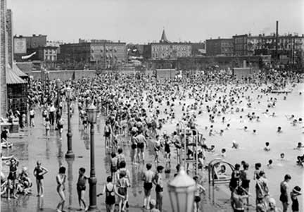
Greenpoint Park, which had opened in 1906, was quickly renamed in his honor. Had he been around, Patrick might have blanched thirty years later when another steadfast politician, Robert Moses, decided to plunk down the biggest of eleven WPA-funded municipal swimming pools here in 1936. Today, the pool is a popular but surprising venue for concerts and is currently being renovated.

Below: McCarren Pool in its heyday, date unknown (Courtesy McCarren Park)

Categories
Podcasts

PODCAST: Williamsburg(h), Brooklyn

Williamsburg used to have an H at the end of its name, not to mention dozens of major industries that once made it the tenth wealthiest place in the world. How did Williamsburgh become a haven for New York’s most well-known factories and then become Williamsburg, home to such wildly diverse communities — Hispanic, Hasidic and hipster? Find out how its history connects with whalebones, baseball, beer, and medicine for intestinal worms.
Listen to it for FREE on iTunes or other podcasting services. Or click this link to listen to the show or download it directly from our satellite site.

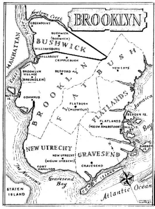
A modern map of the townships of Kings County. Cripplebush is listed here as a settlement in Brooklyn. The dense undergrowth that gave Cripplebush its name stretched well into the jurisdiction of Bushwick, which the Dutch actually called Boswijck.

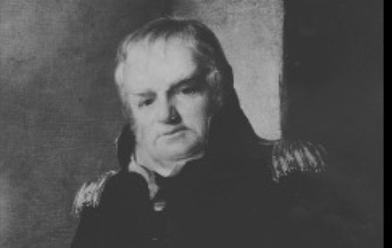
The esteemed Lt Col. Jonathan Williams, who surveyed the land along the Bushwick shore and eventually gave Williamsburg its name. You can also find his handywork at Castle Clinton and Castle Williams (also named after him).

Another father of Williamsburg, David Dunham, can still be found today on a very tiny street near the bridge called Dunham Place. (Forgotten New York has a great look at this odd little side street.)

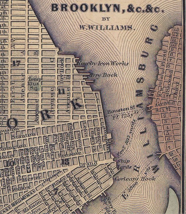
A detail from this mid-19th century map of New York and Brooklyn indicates the two ferry paths across the East River from the Grand Street dock in Williamsburg.

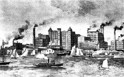
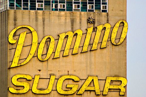
The Williamsburg waterfront during the 1880s. Havemeyer’s sugar refinery became one of the most profitable businesses along the East River. It became Domino Sugar in 1900.

While Havemeyer’s factory, closed in 2004, has been landmarked, its future could include a vast complex of condominiums — but with community opposition and a $1.3 billion dollar price tag, is it viable?

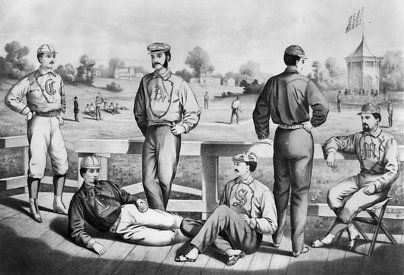
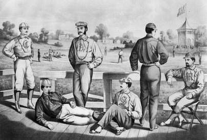
These fancy guys are relaxing after a vigorous game of baseball at the Union Grounds, the first to fence in the playing field and charge spectators. Check out our previous article on this historic place and where you can find its location today.

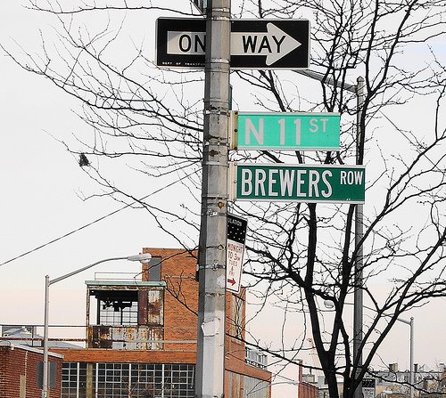
There are no more breweries along Brewer’s Row, but the once grand boulevard of beer makers that stretched from Williamsburg to Bushwick is still recognized on street signs.

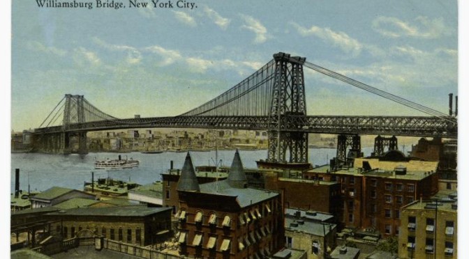
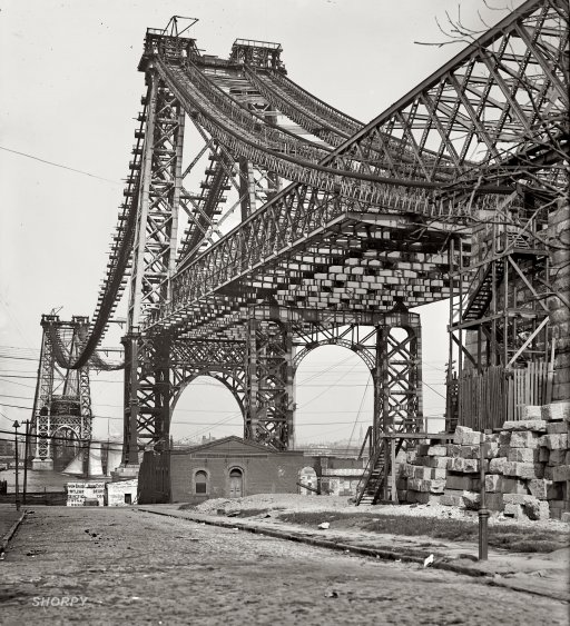
The East River Bridge (today the Williamsburg Bridge) in 1902. It would be opened a year later, opening the neighborhood to thousands of new residents fleeing overcrowded Lower East Side (pic courtesy Shorpy)

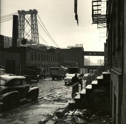
Williamsburg in 1954, not the sunniest place ever. Photo by Alfred Eisenstaedt (LIFE archives)

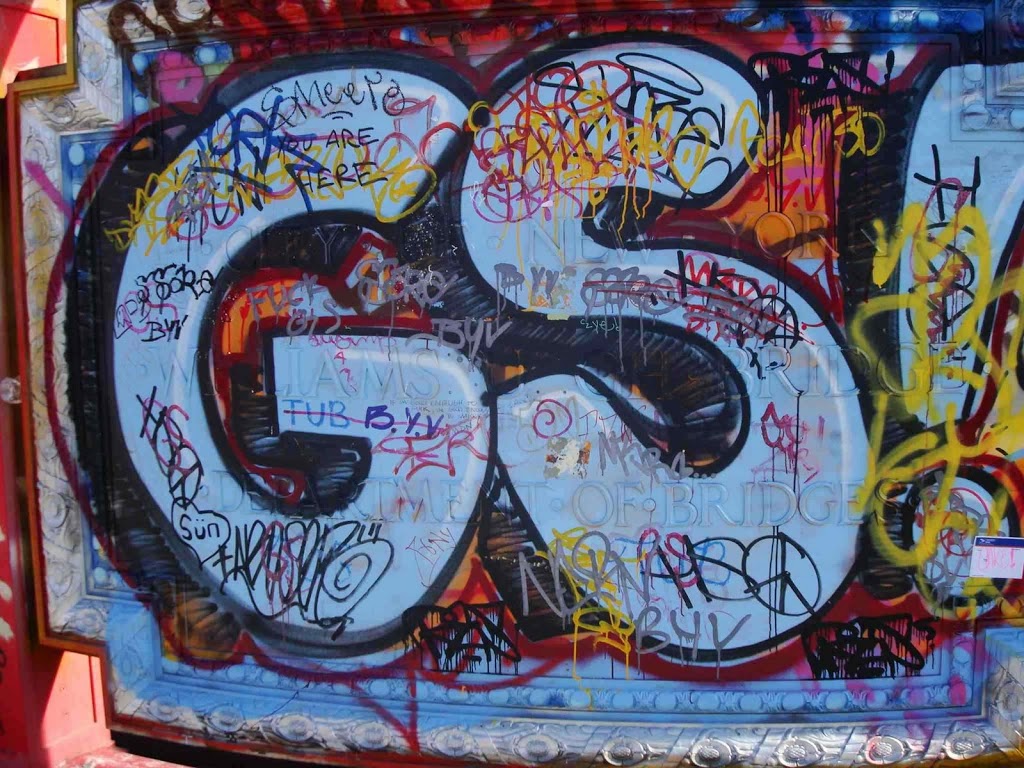
Look really closely at this dedication found at the pedestrian fork on the Williamsburg Bridge. If you scrape away the graffiti, you’ll see Williamsburg with an H on the end. (Click it to get a closer look.)

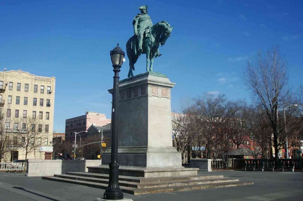
Continental Army Plaza, now overlooking the entrance and exit ramps of the Williamsburg Bridge. An engraving in the sidewalk points towards Valley Forge. The statue and the plaza were installed shortly after the opening of the bridge. So, in fact, this has pretty much always been George’s view.

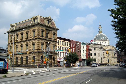
Two gorgeous examples of Williamsburg’s opulent past — the Kings County Savings Bank (built in 1868!) in the foreground, and the George Post’s domed Williamsburgh Savings Bank in the distance. (pic courtesy Flickr)

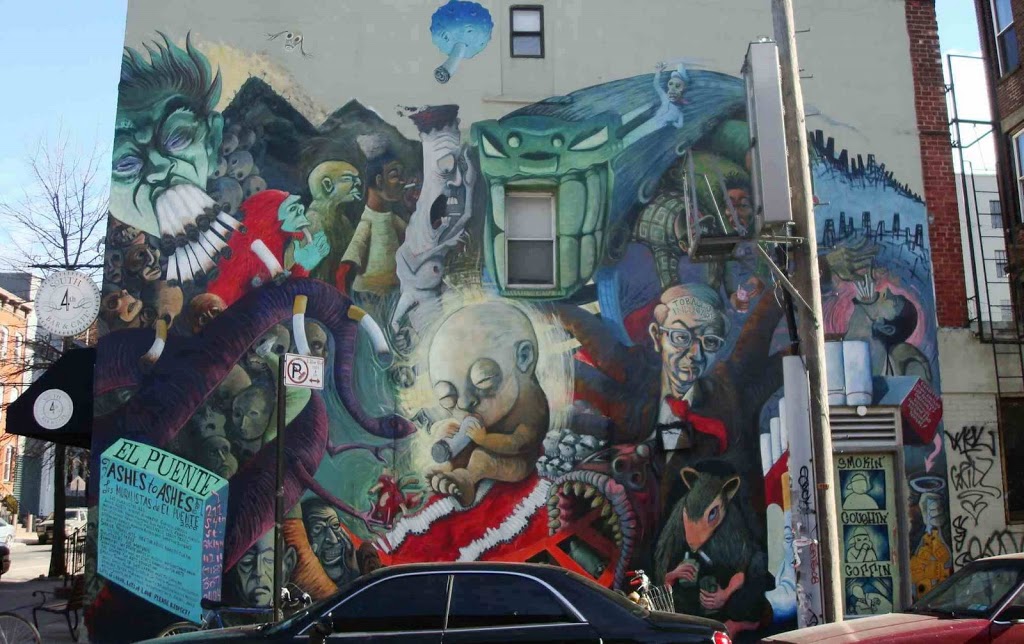
A mural just north of the bridge. Don’t smoke, kids!

Know Your Mayors: George Hall

An engraving of Brooklyn Heights in 1854, the year before George Hall took office a second time

Our modest little series about some of the greatest, notorious, most important, even most useless, mayors of New York City. Other entrants in our mayoral survey can be found here.

I’ve been very Manhattan-centric in this column, so it’s about time I introduce you to a man pivotal to Brooklyn’s history: George Hall, its very first mayor from its days as an independent city (1834-1898).

The various townships of Kings County were growing at such rapid pace that the state officially bestowed a city charter to the town of Brooklyn in 1834. This would leave the county with one true city (Brooklyn) and five official remaining townships (Bushwick, Flatbush, Flatlands, Gravesend and New Utrecht) all of whom would eventually be conjoined in coming years through development and annexation. Later, a second city — Williamburgh — briefly competed for dominance, but it was no match for Brooklyn’s incredible growth and was absorbed in 1850s (hurling its dangling ‘h’ into the East River forever).

By 1896, Brooklyn would come to mean everything within the boundaries of Kings County, just in time for its consolidation with the city of New York just two years later.

That’s the history of Brooklyn in a nutshell. But that first year, 1834, heaped huge pressures on the growing new city, as influential landowners (such as the Pierreponts) raced to reshape the surrounding area to attract residents and new businesses. And the man planted in the driver’s seat, appointed by the city’s municipal charter by Common Council, was George Hall.

Hall was a self-made tradesman, borne of Irish immigrants in Flatbush, a painter and glazier (glass seller) whose successes in the rapidly growing city made him a natural candidate for elected office, first as a ward aldermen then at last as the first mayor.

In 1834, Brooklyn had 20,000 residents and few paved roads outside of its city center (around Fulton Ferry). “There were, within the city, two banks, two insurance companies, one savings bank, fifteen churches and three public school,” Hall later described the scene. “Sixteen of its streets are lighted with public lamps.” Hall brought omnibuses to the city and passed measures to improve the water supply. Working with city leaders, he also purchased a site that would become the future home of Brooklyn City Hall.

Hall was not merely concerned with the physical growth of young Brooklyn. Mindful of the intersection of commerce and morality, the tee-totalling Hall cracked down on “unlicensed rum shops” and reduced that awkward but somewhat common method of street-cleaning — releasing pigs into the street.

Over twenty years later, as the city of Brooklyn expanded to consolidate with Williamsburg, city residents turned to Hall again, electing him for a two-year term in 1855-56.

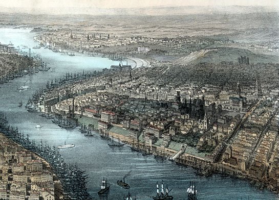
Below: Brooklyn in 1851. See if you can find where the picture above might fit in with the city as depicted below!

In the same speech, Hall gleams with pride over the greatly expanded city that elected him. “Brooklyn, judging from its past increase, yesterday contained a population of about 145,000 persons, and on this day the three places consolidated [Brooklyn, Williamsburg(h), along with the township of Bushwick] into one municipal corporation, takes its stand as the third city in the empire state, with an aggregate population of about 200,000 inhabitants.”

Crisis came to Brooklyn during his tenure with a massive cholera outbreak, which nearly sent Hall himself to his grave. He lived the remainder of his life on 37 Livingston Street.

One of Brooklyn’s most respected men, when Hall finally died in 1868, Henry Ward Beecher rose to give a rousing eulogy to thousands of mourners who filled the streets of Brooklyn Heights.

Unfortunately, I couldn’t find any portraits of George to put in the blog today; however I believe you can find one if you visit the Brooklyn Historical Society. Aafter you’re visiting them, you can take a walk to Hall Street in Fort Greene, which is named after him.

Some info above was obtained from research from thehistorybox.com

Blinded by the lights of Dyker Heights

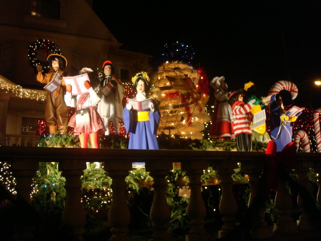
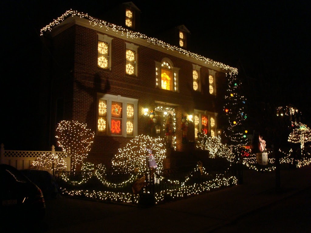
Holiday traditions in Manhattan are of course known the world over, from the lights of Park Avenue to the Rockefeller Center Christmas tree. But they lack that human touch, spun from wealthy corporations and honored tradition. Which is what makes Dyker Height’s annual lighting spectacular (festival? competition? freakshow?) so fascinating. It’s Brooklyn’s biggest holiday event, run entirely by the community.

The extravaganza has energized a neighborhood few in New York know much about. For most of its history, Dyker Heights was virtually uninhabited, either by humans or two-story illuminated snowmen.

Dyker Heights is named for an uninteruppted, sloping meadow which rolled down to the waters edge (today interuppted by the rushing traffic of Shore Parkway). Nobody’s certain where Dyker Meadow got its name, only that it originated from the days of Dutch occupation, either from a Van Dyke family which settled here, or, more generally, from actual dykes the family built to drain the meadow.

Tumuluous history springs up on either side of Dyker meadow and its small forests, as the British who land at nearby Denyce Wharf begin their invasion of Brooklyn in 1776, taking up battle with the Continental Army to the north and east. As part of the township of New Utrecht, the meadow was unsuitable for farming, but its forests were plenty suitable for firewood and materials for building homes.

Development finally came to the area shortly before Brooklyn consolidated with New York. During the 1890s, the nearby area of Bath Beach was quickly becoming a resort getaway similar to Coney Island. Called Bensonhurst-by-the-Sea, the resort adhered to strict moral entertainments (i.e. no booze) and thus was destined to fail. Luckily, by then, an elevated West End train line (the Brooklyn, Bath and Coney Island line, back in the day) was attracting speculators eager to draw New Yorkers with residences built on old farmlands. By 1911, the New York Times excitedly noted the saavy practices of land developers in this region of South Brooklyn.

The father of Dyker Heights is developer Walter L. Johnson, who in the 1890s scooped up the land, brought roads and utilities to this fairly remote part of Brooklyn, and quickly created a small community. He even named the area, the ‘Heights’ assumably tacked on to embue it was a cache similar to Brooklyn Heights. Johnson’s gamble paid off; in 1899, the Wall Street Journal proclaimed, “nowhere else in the consolidated city is there anything to compare it with. From here can be seen a marine panorama hard to beat.”

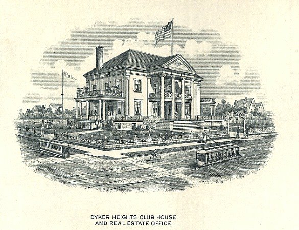
Below: the Dyker Heights Club House, built in 1898

Today Dyker Heights is a predominantly middle- to upper-middle class Italian neighborhood, anchored by the Dyker Heights golf course and sandwiched between Bay Ridge and Bensonhurst, with old Fort Hamilton to the southwest and what remains of the old Bath Beach resort area just southeast of here.

What Johnson could not have predicted — heck, what Thomas Edison, inventor of electric light bulb, could not have foreseen — is the annual holiday expression that occurs on the lawns of many Dyker Heights residences through December.

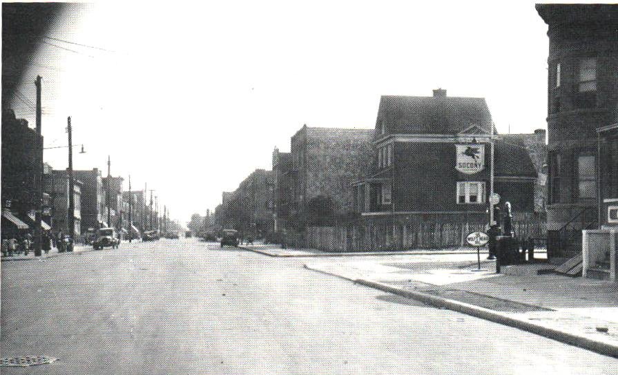
Below: 13th Avenue in Dyker Heights, 1934 (Pic courtesy Dyker Heights community website)

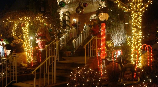
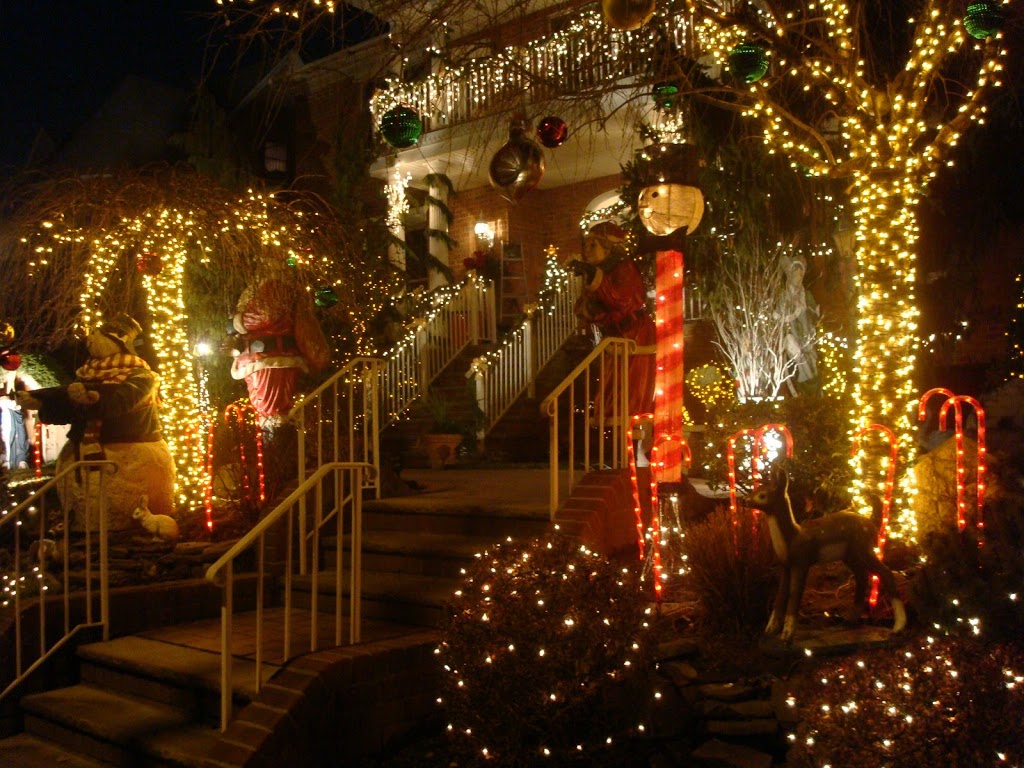
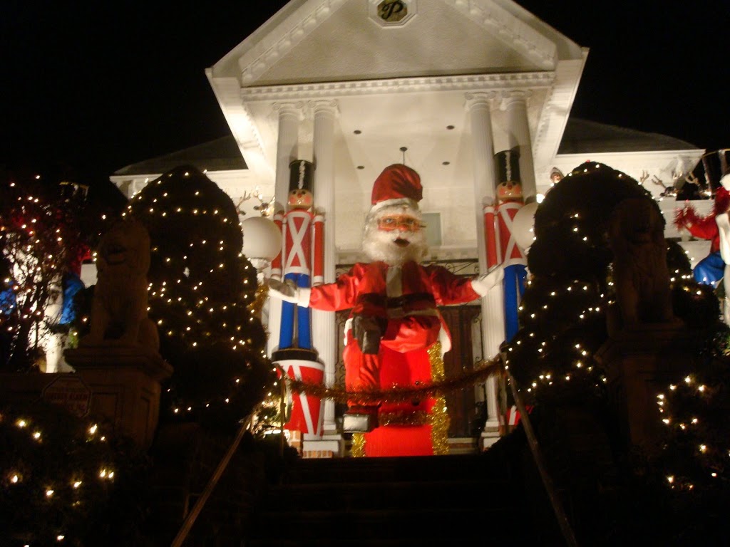
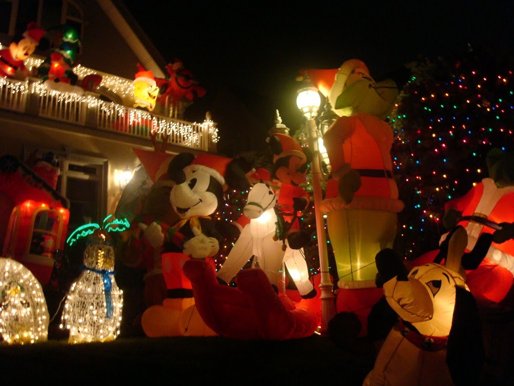
The neighborhood is already known for its unique, ornamented homes, front lawns festooned with fountains, animal statuary, ornate shrubbery, perfectly manicured grass and home waterfalls. For the holidays, the busy lawns are then burdened with an abundance of lighted sculptures, animatronic dioramas, illuminated trees, and every manner of festive lawn display imaginable. (You’re more likely to see a holiday-themed Mickey Mouse than a Santa Claus.) Imagine an eight-year-old child given a million dollars and a mandate for holiday landscaping.

Befitting an organic neighborhood celebration, the origins of this annual tradition are a bit hazy. Families began hosting displays as far back as the post-war years of the 1940s. An article from the New York Times last year suggests that the neighborhood’s Italian leanings may have something to do with it.

The show is concentrated on 84th Street between 10th and 13th Avenues but it easily spills over to other blocks and even into the borders of adjoining neighborhoods. I used to prefer seeing it from the luxury of an automobile, given the cold, but this year I went a bit early (some displays go on as soon as the sun sets) and hoofed it. It’s only a few blocks from a subway, and you get to interact with the various Santas and Elmos. With a good stroll, you can also soak in the Christmas music that seems to emanate from every home.

By the way, much of the history of Dyker Heights was unearthed a few years ago in a thesis paper by then student Christian Zaino. A model example of a budding New York historian, his research was so exhaustive that one of Dyker Heights’ more glamorous homes — the Saitta House — entered the National Register of Historic Places on the strength of his research. In fact, this is probably one of the few instances that you can use Wikipedia for a resource, as Zaino wrote the page.

Where are you, George Post?

Who knew a produce exchange could look so elegant?

One of New York’s most important architects was George B. Post, but you would barely know it today.

Only a handful of his most important buildings — the New York Stock Exchange being the most famous — still stand, the victim of a rapidly changing city sweeping away the former glories of the Beaux-Arts style.

Post wasn’t your typical purveyor of the sometimes gaudy excesses of Beaux-Arts, that amalgam of classical and formal styles that dictated American architecture from the 1880s into the 1920s. He was known for making its particular beauty climb, refitting its graceful symmetry literally to new heights. Post proved that the merely traditional needn’t be staid and uninspiring. My two favorites of long-gone works:

New York World Building

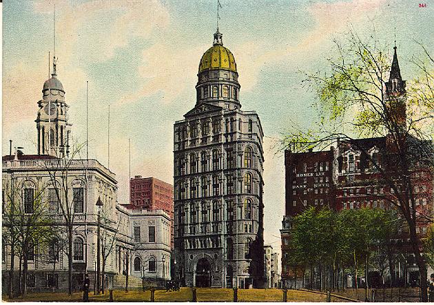
His best known building during his life was the New York World building on Newspaper Row, more appropriate referred to as the Pulitzer building after the paper’s imperious publisher Joseph Pulitzer. It was the tallest building in the world when it was completed in 1890 and was the first building to rise above the spire of Trinity Church.

This was demolished to make way for a car ramp for the Brooklyn Bridge:

(New York Architecture has some more beautiful pictures of this building)

New York Produce Exchange

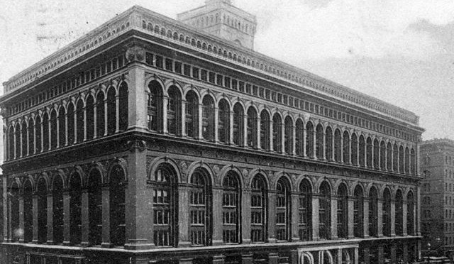
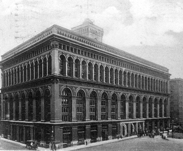
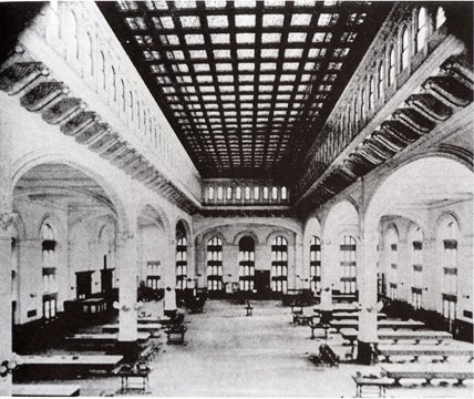
You wouldn’t expect a building made to hold produce to be an architectural marvel, but Post graceful talent at creating lively open spaces made this one, at 2 Broadway down at Bowling Green, a stunner and certainly must have recommended him as the ideal candidate to design the trading room floor at the New York Stock Exchange. The Produce Exchange was wiped out in 1957. (The exterior is shown up top.)

(Picture above, and others of Post’s work, can be found at City Review, reviewing a book of Post’s work by Sarah Bradford Landau.)

Go to New York Architecture to see a sampling of lost Post buildings.

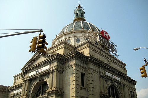
If you’d rather see one of his few existing ones, simply cross the Williamsburg Bridge over to the Brooklyn side, turn left and look for that beautifully domed and very out-of-place beauty that’s now an HSBC bank branch. That’s the Williamsburgh Savings Bank, the little brother of the Williamsburgh Savings Bank Tower and one of Brooklyn’s most beautiful buildings, built in 1875, many years before the bridge sprouted up in front of it:

Union Grounds: Baseball history in Williamsburg

Above: Quite a fancy looking team of baseball players! Note the pavilion in the background. Picture courtesy Brooklyn Ball Parks

I love finding out where very basic, everyday, take-for-granted concepts were invented. For instance, there is some place on the planet I’m sure that heralds as the first place somebody put a straw in a beverage and drank it.

Well, in today’s Williamsburg, in a crowded section inhabited by a mostly Hasidic Jewish population, there once stood a baseball field named the Union Grounds with a unique distinction: it’s the first to regularly charge spectators to watch a game of baseball.

In the mid-19th Century, Williamsburgh was a fairly new independent city, having divested itself from the neighboring town of Bushwick several years earlier to govern itself. The Union Grounds were actually built on the outskirts of the nearby town of Wallabout, but its location on a large patch of land bounded by Marcy Av., Rutledge St., Harrison Ave., and Lynch St. is today in modern Williamsburg.

Believe it or not, baseball had been a recreation for New Yorkers for over 20 years — a New Yorker even invented it — by the time that William Cammeyer built Union Grounds in 1862 from an outdoor skating rink he owned. It would still be used for ice skating during the winter months.

Previously, field owners made profits by charging teams fees to play. Seating was provided at some fields for fans, and spectators were encouraged to stand around and watch, sometimes even around the very baselines.

Baseball was well organized by this time; the first official baseball league incorporated sixteen teams — most of them from New York and Brooklyn. Cammeyer decided to capitalize on the sports popularity in 1869 by fencing in the field and charging the spectators (a reasonable ten cents) for the honor of watching these top-notch squads in action.

Certain teams gravitated to the Union Grounds, loosely giving the field its own home teams. The Eckfords, a team named after a shipbuilder, were league champions that played most of their games here, as did the Mutuals and the Hartford Deep Blues. The field would continue to host teams in the 1870s, when baseball went ‘professional’ and paid players and teams would be associated with particular cities.

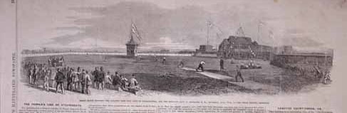
Apparently the field was still making enough money as an ice skating rink that one certain disruptive feature sat in the outfield during baseball season. According to Brooklyn Ball Parks, an elegant three-story pavilion was planted in the middle of outfield, used during the winter to light up the ice at night. (Below is a page from Frank Leslie’s Illustrated Newspaper circa 1865, before the fence went up. However if you click into it, you can see greater detail of the ballfield and this curious feature.)

The field was plowed over on July 1883 and replaced with the 17th Corps Artillery Armory, which still stands there today.

Former location of the Union Grounds:


View Larger Map

New York’s best film performances – Part Two

My list of New York’s best movie scenes continues with two in Brooklyn — and one that almost gets there….

Tension
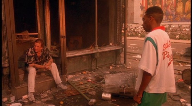
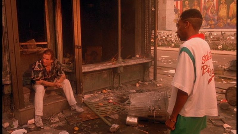
7. Do The Right Thing (1989)
Mookie throws a trash can

Spike Lee is only one of a few directors who knows how to turn New York City into a character in his films. With ‘Do The Right Thing’, he photographs a typically drab streetcorner in Bedford-Stuyvesant with the sorts of color and pizazz more associated with 1950s musicals. Better to match the residents — everybody from the old men on the corner to the customers at Sal’s Pizzeria — a cross-section of vivid characters and a balance of different races getting along. Until, of course, Mookie throws that trashcan through Sal’s window.

The film is loosely based on a violent 1986 incident that occured in Howard Beach, Queens, involving the death of a black teenager after being harassed with his friends at a pizzeria. Mookie’s act of violence — the “did he do the right thing” moment — sparks a mob scene that greatly parallels many incidents during the New York blackout of 1977.

Not suprisingly, Lee goes back to the motif of the ‘hottest day of the summer’ in another great movie actually set in 1977 — “Summer of Sam” — a film loaded with on-location shots in Queens and the Bronx.


Grit
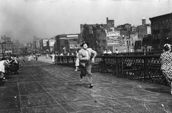
6. The Naked City (1948)
Shootout on the bridge

The Williamsburg Bridge’s best moment ever in a recorded medium is this scene in the Naked City, the climactic chase and shootout in a film already known as one of the best look New York City movies ever made.

Forget the standard issue film noir plot, fun but unspectacular; it’s all about William H. Daniels’ verite cinematography, which won him an Oscar. The Naked City is one of the first film to shoot almost everything on location in New York, 107 on-location scenes in all. The film, and New York, looks better the older it gets.

Among its more famous locales include the ole Roxy Theater, the Whitehall Building, and the City Morgue (!), but its crowning scene is its last, a breathtaking shoot-out literally up in the proverbial rafters of the Williamsburg Bridge. NO film (not even the next on my list) has ever used a bridge to such tangible effect.


Decadence
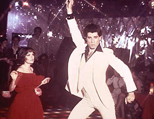
5. Saturday Night Fever (1977)
Tony and Stephanie cut a rug

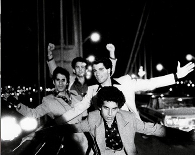
I couldn’t not pick the famous danceoff scene with Tony Manero and Stephanie Mangano. It defines the style of New York nightlife outside the VIP area of the 1970s. But for the record, Saturday Night Fever has two equally beautiful scenes using New York backdrops that are utterly fabulous — Tony strutting down the street with paintcans and, of course, the tragic encounter at the Verrazano-Narrows bridge. I can probably go on record and say ‘Fever’ is the coolest movie about New York City ever filmed.

I’ll save myself some typing and direct you to my writeup a few months ago on Saturday Night Fever and the club where it was filmed 2001 Odyssey, which also includes a report the fate of that sacred dance floor.

By the way, the original name of the movie was ‘Tribal Rights of Saturday Night’, as the film itself is based on a magazine article called ‘Tribal Rights of a New Saturday Night.’

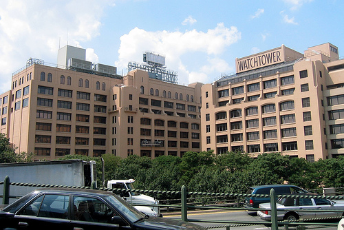
Who watches the Watchtower?


Brooklyn Heights remains today a neighborhood underscored with the industry of religion. However, unlike its halcyon days of the 1800’s, when the Congregationalist churches of Henry Ward Beecher and Richard Salter Storrs Jr. became centerpieces of society, the 20th century brought in the Jehovah’s Witnesses, whose ownership and development of prime Heights real estate has been a point of controversy since the beginning.

Charles Taze Russell formed the Bible Student movement, a subset of the Protestant movement that disavows one of Christianity’s prime tenets (belief in the Trinity), in Pennsylvania but uprooted it in 1908 to settle in the heart of Brooklyn Heights, partially to take advantage of New York’s ports for distribution of their publications.

Under the auspice of Watch Tower Bible and Tract Society, Russell began publishing religious literature for the group. With his death in 1916, the group splintered into further permutations, with the ones most affixed to the Heights and Russell’s original vision settling on the name Jehovah’s Witnesses in 1931.

After World War II, the group rapidly expanded into the heart of the Heights, demolishing many brownstones (including the former homes of Beecher and Washington Roebling) and constructing dormitories for their membership. Although they certainly haven’t been the most calamitous figure in the neighborhood (see Robert Moses and the Brooklyn-Queens Expressway), their buildings are often bland or occasionally eyesores.

Their presence in the neighborhood is on the wane, however. Of the over thirty buildings they own in Brooklyn Heights and DUMBO, they have either sold or are in the process of selling several of them, including the historic Hotel Bossert and the Standish Arms Hotel, for many decades used as a dormitory for its Watchtower employees.

Even they aren’t immune to New York’s most predictable transformation; their bible shipping plant on Furman street was sold for $205 million and transformed into the luxury condo park One Brooklyn Bridge.

Apparently, however, if you live in the neighborhood, you’ll still experience the Witnesses’ tried-and-true door to door antics.

Approximately 3,000 Witnesses live and work in Brooklyn Heights. The Witness community is mostly self-sufficient, with food shipped in from upstate farms, meals served in residence halls, and in-house services — including the making of furniture and detergent — mostly provided by their church. Their buildings are connected by underground tunnels, so most of their daily activities goes by Brooklyn Heights residents unnoticed.

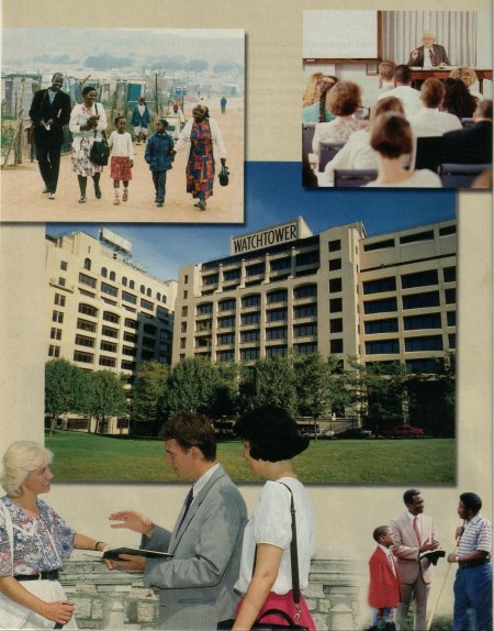
This Times article gives a clear overview of life inside the Watchtower complex. Here’s a page from a Jehovah’s Witness tract that was most likely produced at the Brooklyn Heights publishing plant:

Categories
Podcasts

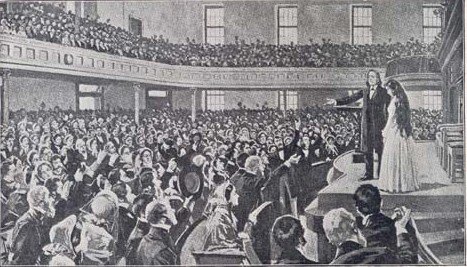
PODCAST: Henry Ward Beecher and Plymouth Church

We’ve never done such a saucy show — full of sex, lies, and petticoats. Meet Henry Ward Beecher, Brooklyn Heights’ most notorious resident, and find out about the fascinating and provocative history of the church that turned him into a national celebrity.

Listen to it for free on iTunes or other podcasting services. Or you can download or listen to it HERE

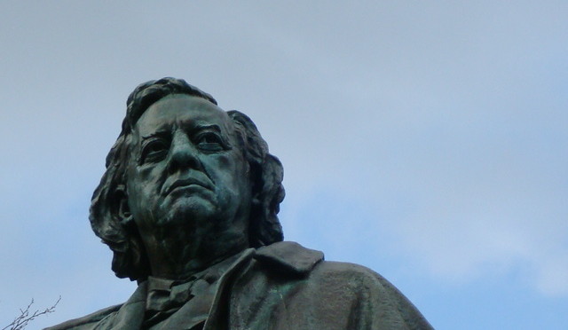
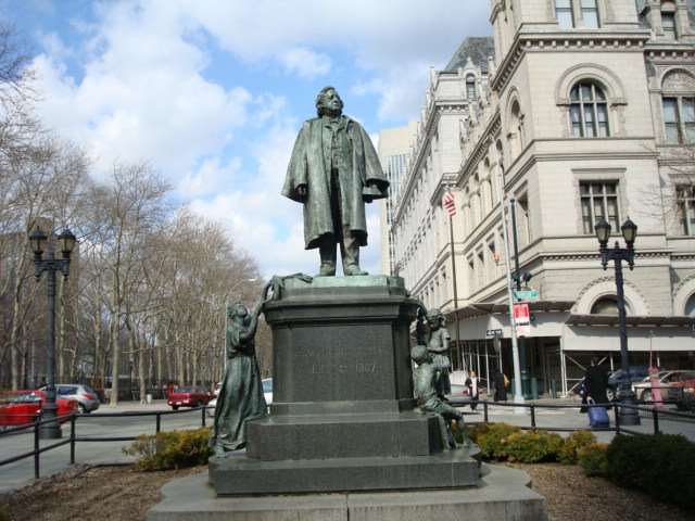
This statue of Beecher sits in Columbus Park in front of Brooklyn Borough Hall. The figure was designed by John Quincy Adams Ward (best known for his George Washington in front of Federal Hall) and dedicated in 1891, just four years after Beecher’s death. The pedestal here is no less austere; it was designed by Ward’s frequent collaborator Richard Morris Hunt, who had recently worked on a significantly bigger pedestal — for the Statue of Liberty.

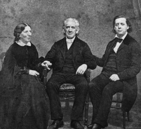
Beecher with sister Harriet Beecher Stowe and patriarch Lyman Beecher:

A depiction of one of Plymouth Church’s ‘slave auctions’.

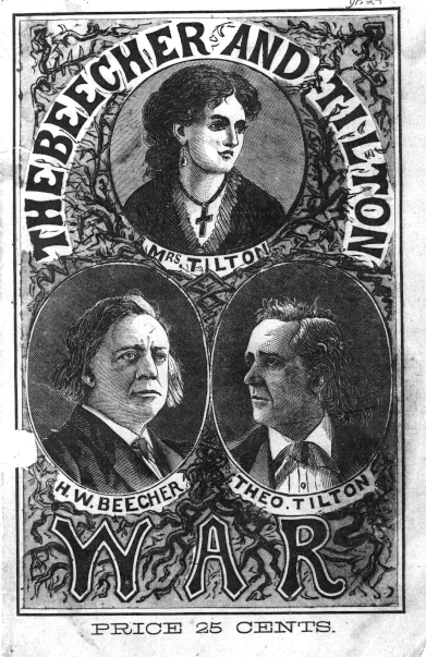
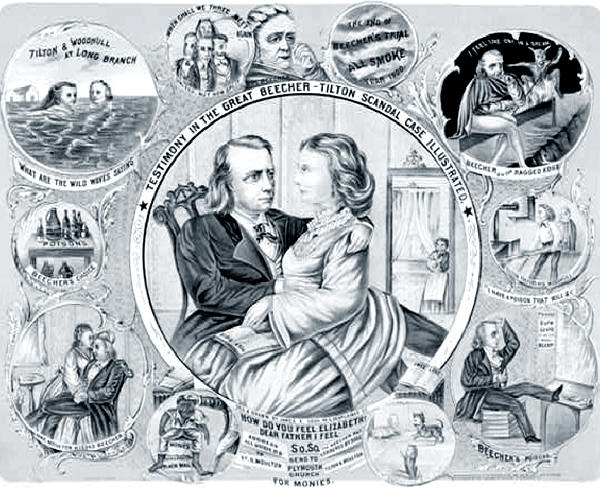
The Beecher-Tilton sex scandal electrified the public’s curiousity and filled newspapers with illustrations such as these:

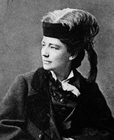
The bold and provocative Victoria Woodhull:

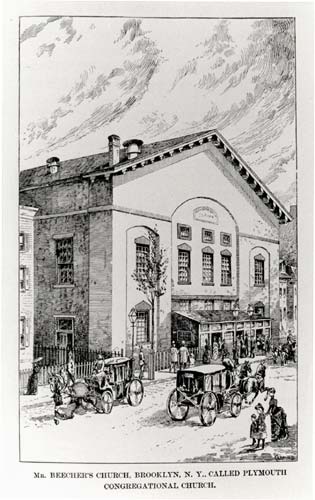
Plymouth Church then:

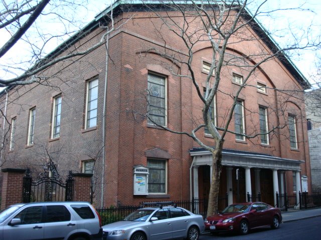
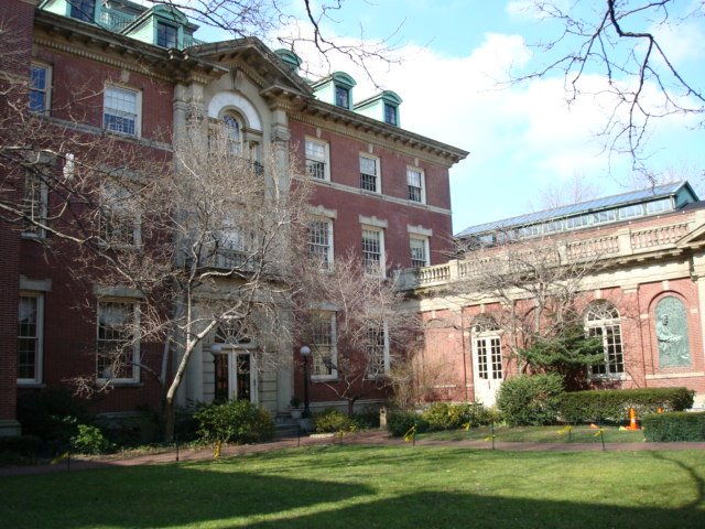
Plymouth Church today:

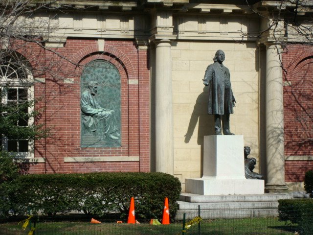
Compare the Beecher statue above with the one that sits on the grounds of Plymouth Church. This one was created by Gutzon Borglum — you might know him for that little rock carving he did called Mount Rushmore. The copper bas-relief nearby of Lincoln is also by Borglum.

Know Your Mayors: William Jay Gaynor

Our modest little series about some of the greatest, notorious, most important, even most useless, mayors of New York City. Other entrants in our mayoral survey can be found here.

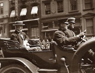
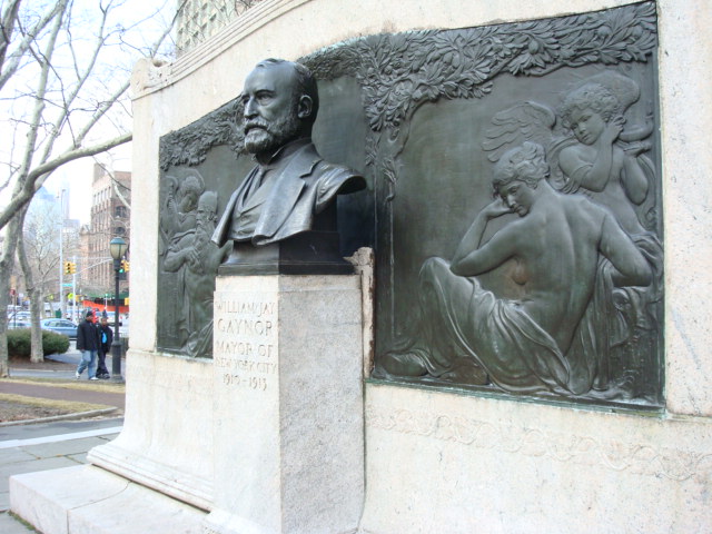
Walk from Manhattan over the Brooklyn Bridge, take the first ramp off the bridge, turn right to Cadman Plaza, and you will run smack dab into a marble slab and the stoic bust (see below) of William Jay Gaynor, mayor of New York City from 1910 to 1913. Very few mayors are honored with statuary in this city, especially a mayor with so short a term in office. Gaynor’s term represented a shakedown of traditional New York Tammany politics, a true bureaucratic reform movement.

But Gaynor is perhaps best remembered as being the only New York mayor to become target of an assassination attempt and to eventually die of his injuries.

It wasn’t supposed to play like this at all. Tammany Hall, entering the dusk of its influence by the early 20th century, thought they had a ringer with Gaynor, a state Supreme Court justice for 14 years chosen to run by still-powerful political machine. One of his opponents — William Randolph Hearst — an early admirer who warned Gaynor to publicly reject his corrupt Tammany sponsors.

Hearst needn’t have worried. Once elected, Gaynor flummoxed his Democratic forebears by eshewing the usual political favors to Tammany cronies and actually hiring qualified individuals in chosen fields. His swiftly became no one’s pawn.

Gaynor continued to live in Brooklyn — 20 Eighth Avenue in Park Slope, to be precise. On his first day of work, he actually walked from home, over the Bridge, and right into City Hall.

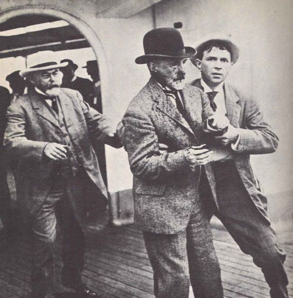
While vacationing on the ocean liner SS Kaiser Wilhelm der Grosse, a disgruntled city employee James J. Gallagher, fired from his job on the docks, took out his frustration on Gaynor, shooting him through the back of the neck. Gallagher claimed, “He took away my bread and meat. I had to do it.” Really, James?

Unbelievably, a photographer for the New York world William Warnecke happened to catch the incident, which quickly became one of the most startling photographs in the short history of photo-journalism:

Gaynor recovered somewhat, although the bullet would remain lodged in his throat, and his entire term of mayor, he would remain weakened and haggard. He would even use the injury as a reason to get out of discussing delicate subjects, saying, “Sorry, can’t talk today. This fish hook in my throat is bothering me.”

The brush with death, paired with his remarkable house-cleaning at City Hall, quickly transformed him into a popular leader, with talk of even running for president. Tammany wouldn’t help him with another term for mayor, naturally, but he was immediately nominated as an independent.

Somebody should have told Gaynor, however, that he should have avoided ocean liners. On Sept. 4 1913 he boarded the ocean liner Baltic for yet another oceanic vacation and six days later was found dead on a deck chair, his body finally giving in to lingering internal injuries. Curiously, Gaynor’s would-be assassin Gallagher had died just a few months prior — at an insane asylum in Trenton, New Jersey.

The New York Press ran a further appreciationof the Gaynor monument itself. Or maybe you’d like to read his extravagent obit from the New York Times.

Categories
Uncategorized

Name That Neighborhood: Fort Greene

Some New York neighborhoods are simply named for their location on a map (East Village, Midtown). Others are given prefabricated designations (Soho, Dumbo). But a few retain names that link them intimately with their pasts. Other entries in this series can be found here.

The Brooklyn neighborhood of Fort Greene gathers some of the borough’s best known riches within its boundaries, including Brooklyn’s tallest building the Williamsburgh Savings Bank, the Brooklyn Academy of Music, and the park in which the neighborhood gets its name — Fort Greene Park.

However, if I’m being critical, the neighborhood should probably be called Fort Putnam, not Fort Greene.

As you’d expect, this area was the location of a vital Revolutionary-era fort used by the Americans to defend themselves from encroaching British forces. Shaped like a traditional five-pronged star, the fort was named after Rufus Putnam, a general whose claim to fame would actually come post-war, as the head of the Ohio Company, which purchased and settled the territory of Ohio.

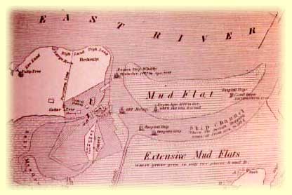
Below: An old map of Fort Putnam and Wallabout Bay

Fort Putnam was one of three forts in close proximity to create a (what would be unsuccessful) defensive barrier. One diamond-shaped fort called Fort Box (named after major Daniel Box) sat smack near the border of today’s Cobble Hill. The third fortification — get ready to be confused — was Fort Greene. The first Fort Greene, also a star shaped fortification, sat between Box and Putnam.

This fort was named after major general Nathaniel Greene, who would become one of the war’s most successful officers and essentially Washington’s most trusted adviser. Greene did oversee the construction of Fort Putnam, so figure in his post-war fame into the equation, and it will not be a surprise to discover that the fort was renamed Fort Greene for its potential use during the War of 1812.

Many old fortifications were refitted in 1812 in case of another British invasion, including the first Fort Greene (now called Fort Masonic). The British did attack Washington D.C. and Baltimore during the War of 1812, but never bothered to make it up to New York harbor this time around.

And just in case you’re interested, during the War of 1812, Fort Box was renamed Fort Fireman.

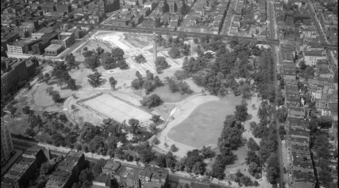
A neighborhood soon developed around Fort Greene, and by 1847 the fortification was replaced by a park — Washington Park — to be later replaced by the rolling, monument bedecked, Olmstead-and-Vaux designed Fort Greene Park in 1864.

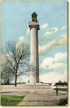
Tying the park back to its Revolutionary War past is its crowning monument, the Prison Ship Martyr’s Monument(at right), honoring those who died in British prison ships kept not that far from here in Wallabout Bay (that’s basically the small bay between the Williamsburg and Manhattan bridges on the Brooklyn side).

Categories
Podcasts Revolutionary History

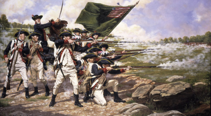
PODCAST: The British Invasion: New York 1776

It’s 1776 and revolution is in the air. Join the Bowery Boys as we tackle the British invasion and takeover of New York City.

Listen to it for free on iTunes or other podcasting services. Or you can download or listen to it HERE

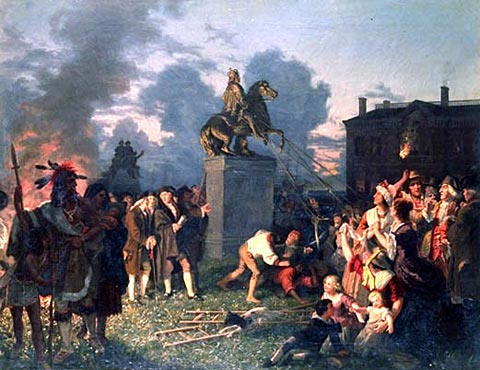
Worked-up New Yorkers, rushing down to Bowling Green to rip down the statue of King George

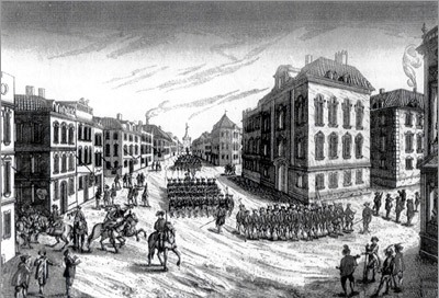
British troops march on New York, Sept. 15, 1776

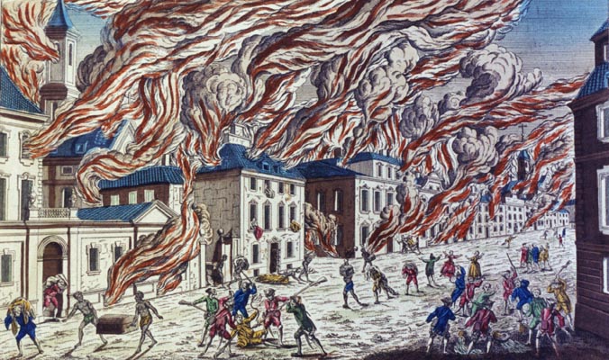
A ghastly woodcut displaying the Great Fire of 1776

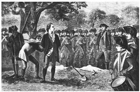
A depiction of the hanging of Nathan Hale:

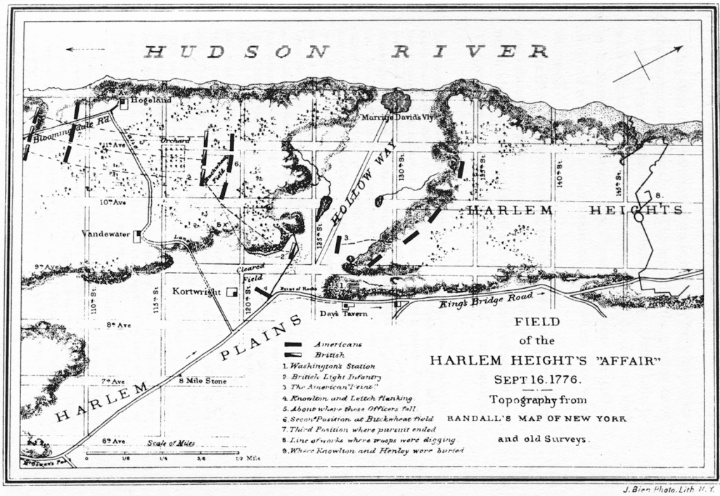
Map of the Battle of Harlem Heights (click on map to see detail):

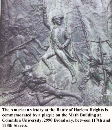
And finally, courtesy of the website of Columbia University:

From past blog entries:
Find out what really happened to that statue of King George.
And last fall we found some modern patriots wrecking havoc downtown.