Categories
Bridges

The patriotic story of how the Kosciuszko Bridge got its name


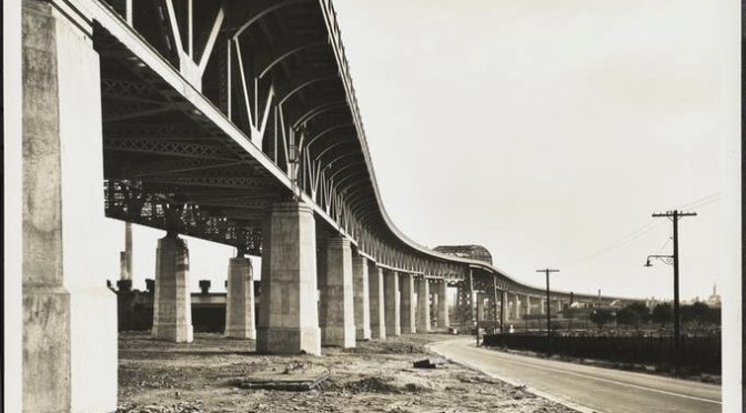
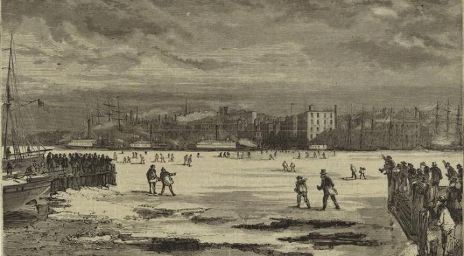
The approach to the Kosciuszko Bridge, photographed in 1939 by the Wurts Brothers.  Photo courtesy the Museum of the City of New York


“That sound that crashes in the tyrant’s ear – Kosciuszko!” — Lord Byron

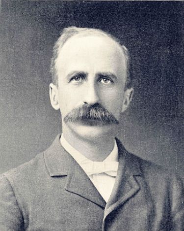
Byron was talking about Polish hero Tadeusz KoÅ›ciuszko, who was (most likely) born on this date in 1746.  Hopefully, within a couple months, the bridge that bears his name — and bears the grievances of those stuck upon it during rush hour — will begin a much-needed makeover.

But how did the span over the Newtown Creek, connecting Brooklyn to Queens, get named the Kosciuszko Bridge in the first place?

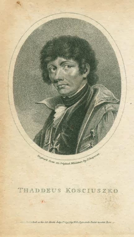
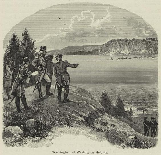
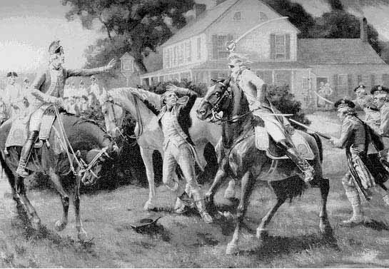
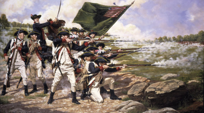
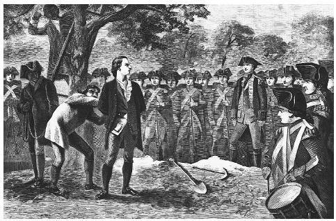
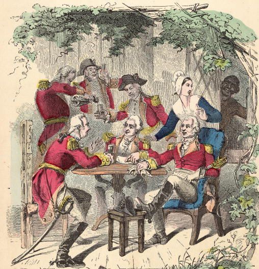
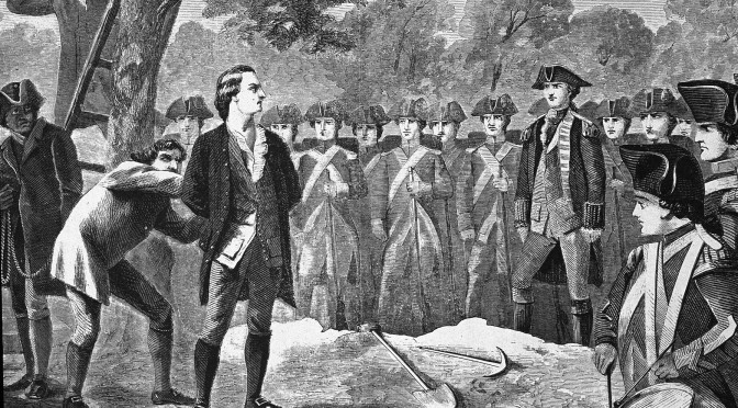
Kosciuszko wasn’t just Poland’s most famous revolutionary.  In 1776, he sailed for America to fight alongside George Washington and the Continental Army.  He was a brilliant strategist and engineer, helping bolster many American forts, and was greatly admired by Washington’s generals.  In one of his more clever displays, the man who would one day have a bridge named after him actually blew up several bridges to hamper British advances in upstate New York.**
After the war, he returned to Europe and led the fight for Poland’s independence (although his storied uprising against Russia was ultimately a failure).

Kosciuszko died in 1817 and has been celebrated the world over as the greatest of revolutionaries and perhaps the best known historical figure in Polish history.  But that alone doesn’t get one a bridge in Long Island.

The new automobile bridge, eventually part of the Brooklyn-Queens Expressway, was completed in 1939, replacing a smaller one called the Meeker Avenue Bridge.  The new crossing opened in August. Germany invaded Poland nine days later.

New York City’s affinity with Poland was strong by this time. The city had thousands of Polish-Jewish residents.  The Polish pavilion at the World’s Fair in Flushing-Meadow was among the most striking, featuring a bold statue of the Polish monarch Wladyslaw Jagiello.  (That statue was eventually moved to Central Park, where it sits today near the Turtle Pond.)  Some New Yorkers feared a similar invasion upon its own shores.

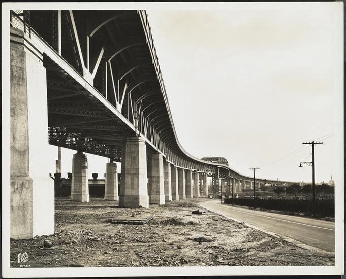
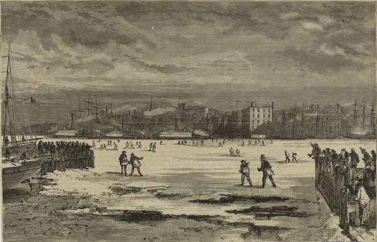
Below: Construction of the new Meeker Avenue Bridge in June 1939, later to be named Kosciuszko. (Courtesy NYC Municipal Archives) 

In July 1940, the Meeker Avenue Bridge was renamed the Kosciuszko Bridge, as a sign of the revolutionary spirit that bonded America and Poland.  It certainly made sense given that the Brooklyn anchorage rises from Greenpoint, a vibrant Polish neighborhood.

At an official ceremony on September 23 — a year after the German invasion — thousands of Polish-Americans cheered along to a rousing patriotic speech by Mayor Fiorello La Guardia.  On either side of the bridge were parades featuring revelers in traditional Polish costumes.

“[I]n so far as the American people and the American government are concerned,” said La Guardia, “the free government of Poland still lives and will continue to live.”

The crowd roared with applause at the mention of President Franklin D. Roosevelt.  America would not be officially engaged in World War II until the following year with the attack on Pearl Harbor.

Ah, but that name!  It remains one of the more perplexing bridge names to say.  It’s correctly pronounced kohsh-CHOOSH-koh, although several slight variations are accepted.  At first, many people simply refused to say it.  In 1945, the New York Times mentioned that “Kosciusko Bridge the people will not have and they call it the Meeker Avenue Bridge to this day.”

Of course, many people preface the name today with an expletive, as the bridge is better known for its traffic entanglements and its lack of any kind of shoulder for stalled cars.  There have been plans for years to replace the bridge, plans which finally look to be rolled out this year.

The Kosciuszko’s younger brother bridge — the Pulaski Bridge, named for another Polish hero, Kazimierz Pulaski — spans the same body of water just a couple miles to the west.

**Tadeusz Kościuszko actually blew up and booby-trapped many bridges during the Revolutionary War on the command of Colonel Philip Schuyler, the father-in-law of Alexander Hamilton.

Categories
Revolutionary History

From prison to post office: The odd fate of a Dutch church

Say a prayer for the Middle Dutch Church (pictured here from sometime before the war) as things are about to get very ugly.

 One need only walk past the old Limelight in the neighborhood of Chelsea to understand the strange flexibility of church architecture.

This former Richard Upjohn-designed Episcopal church at West 20th Street and Sixth Avenue was transformed into a rehab center in the 1970s, then a notorious nightclub in the ’80s, then an upscale mall. And now a gym.

But the Limelight is only the most extreme example of church alteration in New York. Brooklyn Heights has so many churches that some have been turned into swanky loft apartments.

This is not a new trend. New York grew so rapidly in the 19th century that small stone and clapboard churches, once situated on the outskirts of town, found themselves surrounded. As population shifted, congregations left, and other civic services moved in.

The Middle Dutch Church was built between 1726 and 1731, a vestige of Manhattan’s Dutch Reformed community that traced itself back to New Amsterdam‘s very first house of worship.

Its location at Nassau Street and Cedar Street made it central to the lives of colonial New Yorkers, but a series of historical twists ensured a few less hallowed activities would take place here.

The church and the adjoining ‘sugar house’ in 1830, years after being turned into a horrifying prison complex.

During the Revolutionary War, the occupying British turned the damaged and deteriorating Middle Dutch and its neighboring sugar house into a prison for unruly rebels.

An old Times article estimates that up to 8,000 prisoners were held here in those years.  “When the victims confined to the Middle Dutch church crawled to the windows begging for food, a sentinel, pistol in hand, would turn back the gifts of the charitable.” [source]

“The whole floor of the Church was one caked mass of dead, dying, excrement and vermin,” reported the Times, “supernatural” conditions that probably echoed throughout the entire city, choked off during the occupation years between 1776 to 1783.

I’m grimly speculating that prisoners were transferred the prison ships of Wallabout Bay at some point, for the building was emptied, “the planking torn up, tan laid down, and a riding-school established for the recruits of the English riding-horse.”

When the British galloped out of New York entirely in 1783, the beat-up old building sat virtually unused — although Benjamin Franklin may have used the belfry for electricity experiments, according to one source — before being turned back into a church, re-opening on July 4, 1790.

It stayed as a church for 44 years, even as New York’s population migrated north. Finally, under a cloud of debt, the church permanently closed in 1844, with its final service symbolically held in both English and Dutch languages.

If Franklin (America’s first postmaster general) indeed practiced with electricity here, then the next transformation seems natural.

With the federal standardization of postal rates in 1845, New York found itself in need of a central post office. So the U.S. government leased the old church — buying it outright in 1861 — and radically transformed the building into New York’s central post office.

Special delivery: The interior of the Dutch church turned post office in 1871 (NYPL)

The poor building, renovated and stretched thin, could barely process the flow of mail coming through the city by the late 1860s, so a new central post office was built — the odd, greatly loathed City Hall Post Office building.

The old Dutch church, now 150 years old, was considered a city treasure, but real estate in downtown Manhattan was now being carved out for skyscrapers.

Below: The post office/church in an 1877 lithograph, courtesy the Museum of the City of New York

The church of a thousand faces, to the curiosity of “thousands of relic-hunters and citizens,” was finally torn down and replaced with the Mutual Life Insurance Building in 1882.

The ornate Mutual Life had a good run but was demolished — with a part of Cedar Street erased — to make room for One Chase Manhattan Plaza.

And finally — perhaps the only existing photograph of the old post office, dated 1890, Nassau Street – Cedar to Liberty Sts. (courtesy the Museum of the City of New York)

Notes from the Podcast (#121) Fraunces Tavern

Courtesy Flickr/Harry J. Bizzarro

A slight correction:
I inferred in this week’s show that the very first Supreme Court — with Chief Justice John Jay — met in Federal Hall. They actually first convened on February 2, 1790, in a building very close by to Fraunces — the Royal Exchange Building. Also called the Merchant Exchange, the Court’s first home was located at Broad and Water streets, making it practically Fraunces’ neighbor. At the time there were only six justices that served on the court.

It was completely unsuited for such important work. According to writings from 1920 by Joseph Bucklin Bishop, the Exchange was “a very curious structure, for its ground floor was open on all sides, and in tempestuous weather the merchants who gathered there for business found it extremely uncomfortable. It had a second story which was enclosed and consisted of a single room” [source] Here’s an illustration of this odd building:


By 1791, the court moved to Philadelphia. A more dignified Merchants Exchange was later built in New York and featured a well-regarded statue of Alexander Hamilton in its rotunda. Unfortunately this building was promptly burned down in the Great Fire of 1835.

Oldest Building?
So, is Fraunces Tavern really the oldest building in Manhattan? It really depends on how much leeway you’re willing to give it. There’s been a continually standing structure there since 1719, easily outdistancing two other Manhattan buildings, St. Paul’s Church on Broadway and Fulton streets (1766) , and the Morris-Jumel Mansion in Washington Heights (1765).

Fraunces, however, has gone through a host of radical changes to its appearance, with floors added and removed, its rooms reconfigured and its exterior entirely altered as to render it almost unrecognizable. A renovation in the 1900s by architect William Mersereau did bring it closer to its original state. There are certainly elements from the original structure that remain. Is that enough to bestow it the title Manhattan’s oldest building?

There are several buildings in Staten Island, Brooklyn and Queens that lay claim to being much older. You can read about some of them here.

Downstairs at Fraunces:
You can read the story about the alleged ‘dungeon’ underneath Fraunces Tavern here: MAY HIDE DARK SECRET OF FRAUNCES’S TAVERN; Proprietor Likely to Conceal Noisome Dungeon from “Blisters.” SO HE TERMS THE BUYERS

Places to Visit:
You can find directions and hours to the Fraunces Tavern Museum here. We recommend hanging a right at the second floor and watching the short introductory video before exploring the room.

When you’re done with the museum, head on up Pearl Street one block north to see some curious ruins under foot, the remnants of old Lovelace’s Tavern. Bricks embedded in the sidewalk also indicate where the Stadt Huys (or New Amsterdam’s city hall building) once stood.

Learn more:
Pearl Street sat along the edge of Manhattan in the 1660s, meaning the land Fraunces sits upon today would have been water and docks. This interactive map from PBS’s Dutch New York display illustrates this pretty effectively.

Curious to learn more about New York during the Revolution? Check our two-part podcast series from 2008: The British Invasion: New York 1776 and Life In British New York 1776-1783.

There’s not any real contemporary books on Fraunces Tavern history, but you might find this artifact from 1919 of interest — A Sketch of Fraunces Tavern and Those Connected With Its History, a short ‘official’ history by Henry Russell Drowne, a member of the Sons of the Revolution.

Drowne was best known as a collector of coins and printed money but was active in New York historical preservation as well. In stark contrast to his name, Drowne died in a house fire on the Upper West Side in 1934.

Blue Bell Tavern: War and romance in Washington Heights


The Blue Bell Tavern, a rustic pit stop along Bloomingdale Road, witness to the changing fortunes of war. (Courtesy NYPL)

FRIDAY NIGHT FEVER To get you in the mood for the weekend, on occasional Fridays we’ll be featuring an old New York nightlife haunt, from the dance halls of 19th Century Bowery, to the massive warehouse clubs of the mid-1990s. Past entries can be found here.

LOCATION: Blue Bell Tavern
181th Street and Broadway, Manhattan
In operation Early 1720s-1915(?)

An old stone tavern once stood high upon the bluffs of Upper Manhattan, in an area many years later referred to as Washington Heights. The Blue Bell Tavern sat off Bloomingdale Road (where Broadway stretches today) nestled in a grove of trees, a modest two-story dwelling alit at all hours with wanderers.

One cold, stormy night some evening in November 1783, a damp and exhausted figure strode up to the door, a young woman who had escaped from her home many miles away. She was there to meet her lover who had already arrived at the Blue Bell, a man soaked, in disarray and wearing what certainly would have been a common sight for the day — a British uniform.

This man was a sergeant in the British military stationed in the Hudson River Valley. But the army was now retreating. Indeed, they were leaving New York that very month.

But he had fallen in love with this woman, who (as these sort of stories go) we know little about. We do know her parents disapproved of the British sergeant and would only relent to their marriage if he agreed to desert the army and remain in the United States.

On that rainy evening, the sergeant and his beleaguered love were married, here at the Blue Bell Tavern. As the story goes, it was a Quaker ceremony, for there were no other officiators that night at the tavern.

The Blue Bell, situated at today’s intersection of 181st Street and Broadway, was built in mid 1720s as a home and renovated into the type of pleasant inn that, by 1753, the venerable Cadwallader Colden (not the former mayor, but his grandfather and later governor of New York) could find “very comfortable” food and lodging with his friend James Delancey, the state’s lieutenant governor.

The tavern might have faded peacefully into oblivion if not for the Revolutionary War. When angry New Yorkers attacked the King George statue in Bowling Green at the foot of the island, his stone head ended up on a pole in front of the Blue Bell.

While the Continental Army fled from Manhattan during the month of September 1776, officers stationed here at the Blue Bell assessed their grim situation and coordinated the army’s next steps. With the tavern located so close to a key pathway out of town, it also became a headquarters and lodging for British officers after Washington’s army left. At one point, even Colonel William Howe, head of the British forces, himself stayed here.

It was during early battles in New Jersey that one British officer, one Colonel Ralle, found true love at the Blue Bell in the form of the innkeeper’s sister, and he married her there within the day. It would not be the last torrid romance to blossom here.

In November of 1783, George Washington and his victorious army re-entered New York, this time to push the British out of town and experience a new, free American nation from the vantage of the ravaged port city. “I remember well our march up the hill, and the noble appearance of George Washington as he sat on his big bay horse,” said a ‘veteran’ of the war in Appleton’s Journal.

George would even stay for an evening at the Blue Bell, awakening early to prepare his army’s grand entry down Bloomingdale Road and into the city. (Another important tavern of the day, the Bull’s Head, would also play a prominent role in Washington’s arrival into the city.) But on that day, they would add two more people to their procession.

The colonel and his new bride — the ones whose rendezvous at the Blue Bell led to their Quaker marriage — emerged from behind the building and called out Washington’s name. Given his rumpled British uniform, I imagine this created quite an uproar. The pair were taken into custody, and the British officer recounted his romantic tale. He wished to desert the army and join the Americans if only they would provide protection for him and his young bride. Indeed, with so many Loyalists still in the city, the soldier’s betrayal would certainly have been met with retaliation.

The tale apparently amused the troops, flush with the excitement of victory. Somebody even wrote a poem in the couple’s honor. You can read the whole thing here, though it begins: “A soldier and a maiden fair, Helped by shy little Cupid, Fled from the camp and momma’s chair, (Such guardians, how stupid!), And to the Blue Bell did repair, To have themselves a-looped.” We can assume with the lighthearted tone of the poem that things turned out well for the happy couple.

Below: A miniature of the Blue Bell, displayed at the Museum of the City of New York when it opened the doors to its new Fifth Avenue home in 1930. (Courtesy LOC)

The old tavern passed through many owners (and many names) through the 19th century and eventually returned to its original purpose as a residence. One old source suggests that the building burned to the ground in 1876, though it may have survived this blaze into the new century. Whatever structure stood here then was torn down by 1915. But tales of the Blue Bell entered nostalgic accounts of the Revolutionary War almost immediately, as 19th century historians struggled to piece together the American narrative from those who still remembered it.

The Blue Bell lived on long after its demolition in a most curious way — as a well-known miniature housed at the Museum of the City of New York. An issue of Popular Science Magazine from 1930 observes the construction and installation of the Blue Bell exhibit, which made its debut that year in the museum’s new home on Fifth Avenue and 103rd Street.

On some days, you can go to the former spot of the Blue Bell Tavern and experience a Gothic romance of your own. Standing there today is the RKO Coliseum, once one of Manhattan’s largest movie theaters, still operating as Coliseum Cinemas. (Here’s a street view of that corner.)

Below: The Coliseum in Washington Heights, date unknown (but there’s a vaudeville bill on one of the marquees!)

Old Swamp Church and the first U.S. Speaker of the House


Federal Hall, home to the first House of Representatives 1789 [NYPL]

This week the United States got a new Speaker of the House of Representatives, John Boehner, and its first female ex-Speaker, Nancy Pelosi. This changing of the guard got me to wondering how many politicians representing New York had ever held this powerful job.

Surprise! No House representatives from the City of New York have ever been Speaker. The closest we’ve gotten is the otherwise unremarkable John W. Taylor, an upstate New Yorker from the Saratoga region, who briefly held the job in 1820-21. A central New York representative, Theodore Medad Pomeroy, held the post for exactly one day in 1869.

But never fear! America’s very first Speaker of the House, Frederick Muhlenberg, has a New York connection wholely unique and never to be repeated — he is the only Speaker to have served within that role in New York proper, in the months of 1789-1790 when the city was also the nation’s capital, and the center of government sat in Federal Hall on Wall Street.

And that was not Muhlenberg’s only tie to the city. Although he served in the House as a representative from Pennsylvania, he had previously lived in New York for two years during a truly volatile moment — the years before the Revolutionary War.

His name will probably sound familiar if you’re a Lutheran. His father Henry Melchior Muhlenberg is considered “the patriarch of the Lutheran Church in North America,” coming to the British colonies from Germany in 1742 by request of several American ministers in need of spiritual direction. Henry spread Lutheranism throughout the colonies, principally to German and Dutch settlers, and for a time in 1751 even lived in New York, uniting the Lutheran congregations here.

He spawned a true religious dynasty as three of his sons entered the ministry. Frederick (pictured below), born in 1750 in Trappe, Pennsylvania, trained at several small churches in the state before moving with his family to New York in 1774. Lutherans were by no means plentiful in New York during this period, but they worshipped in various small congregations throughout the city, including some services at Trinity Church.

Young Muhlenberg, however, took up with a new church situated just east of the city commons, the newish stone Christs Church at the southeast corner of Frankfort and William streets, affectionately referred to as the Old Swamp Church.

When that house of worship was built in 1767, this area of the city, sparsely populated, was called the ‘swamp’, not so much for the topography perhaps as for the grim-smelling leather shops and tanneries that sat here. Collect Pond, which attracted these sorts of businesses, was but a stone’s throw away, and the area retained its air of industry even as the tanneries moved out and the presses (that would soon comprise Park Row’s newspaper district) moved in.

The congregation didn’t seem to mind however, especially now that they had a venerable Muhlenberg as their leader. And they certainly needed him by this time. In fact, he might had come to New York during this period specifically to reassure a tense congregation amid the tensions that were stewing within the city.

The city of over 22,000 inhabitants was being ripped apart with rebellion, as New Yorkers, caught in an increasing spirit of independence, fought back against British tyranny. From the steps of Old Swamp Church, members would have seen the ‘liberty poles’, hanging in the commons and festooned with banners, and heard (or participated in) regular rallies there. The clandestine Sons of Liberty would conduct secret meetings in nearby taverns, and services would have been interrupted with sounds of the Sons’ many retaliations against British officials.

Congregants felt the inevitability of war; it would surely dominate their prayers by 1774. Having the guidance of Muhlenberg, son of the colonies’ most prominent Lutheran, would certainly be of great relief.

It seems, though, that Muhlenberg himself was at odds with his role. He was not bold or rebellious himself and he initially believed the conflicts were none of his business. Even as his brother Peter Muhlenberg, a Virginian who embraced the rebel conflict, would join the fledgling Continental Army in 1775, Frederick himself was not yet convinced. He wrote his brother: “You have become too involved in matters with which, as a preacher, you have nothing whatsoever to do and which do not belong to your office.” [source]

Revolution was invitable. But Frederick was a theologian, cautious and steady, and he worried not only for his congregation but for his own family. This passivity would soon fall away. When actual bombs began reigning down on the city, he sent his pregnant wife and children away to Philadelphia. He remained for a few months to officiate over a dwindling flock but soon fled himself in the first months of 1776, looking over his shoulder at a city soon to be paralyzed by war.

Below: An illustration from ‘D.T. Valentine’s Manual, 1859’, looking up from William Street from Frankfort. The building immediately to the left was the old Swamp Church, no longer in service and heavily redone by the mid-19th century.

He returned to New York in 1789 as one of the most powerful men in the new government of the United States. Muhlenberg spent the war in Pennsylvania and soon found his footing there as a political leader, becoming a member of the Continental Congress and later elected as speaker to Pennsylvania’s own state House of Representatives in 1780.

According to author Paul Wallace (in his excellent book ‘Muhlenbergs of Pennsylvania’), Frederick wasn’t merely heeding a patriotic call. He had grown a little exhausted of the pulpit and wanted to develop his new course, one of his very own.

Muhlenberg’s austere character and unblemished reputation served him well in politics. He led Pennsylvania’s ratification of the Constitution in 1787. When the first national Congress was formed, Muhlenberg represented his state at their first meeting in the new temporary capital and his old home — New York. His election as Speaker made perfect sense; he had a well-known last name that had helped define American spirituality, and he came from a state neatly between that of President George Washington (from Virginia) and Vice President John Adams (from Massachusetts).

The first House of Representatives met on April 1, 1789, at Federal Hall at the junction of Wall and Broad streets, just south of Old Swamp Church (which now thrived under new leadership). Muhlenberg would help shape the first traditions of the House and define the rules as dictated by the Constitution, its ink still dry and untested. Most notably, his was the first signature to grace the Bill of Rights.

He grew into a tolerant and jovial leader, best known for inviting fellow Congressmen over to his home for fairly elaborate ‘oyster suppers’. Muhlenberg would remain Speaker of the House for the entirety of the first Congress, even as they moved out of New York at the end of 1790. He stayed in the House through 1797, become Speaker again for the Third Congress in 1793.

Muhlenberg’s name has been attached to some rather scandalous events. He was one of three men brought into the confidence of Alexander Hamilton during a blackmail scandal involving his mistress Maria Reynolds. Muhlenberg was sympathetic to Hamilton’s predicament; one of the other three men, political enemy and future president James Monroe, was less so.

In 1796, during congressional battles over funding for the Jay Treaty, Muhlenberg broke a tie vote authorizing the highly controversial treaty to go forward. As a thank-you, his anti-treaty brother-in-law stabbed him in retaliation. He recovered, but family dinners must have been very awkward after that.

Muhlenberg retired shortly thereafter and died in his home in Lancaster, Pennsylvania, in 1801.

As for the Swamp Church, its members slowly drifted away, and the property was purchased by tobacco mogul George Lorillard. The Lorillards also have very deep scars due to the Revolutionary War, but that is another story.

Below: the location of Old Swamp Church

View Larger Map

Illustration of the Swamp Church from an 1894 New York Times article.

Fun on the ice: Party time atop the frozen East River

Daredevils trespassing the ice between New York and Brooklyn in 1871.

I spent much of New York’s Christmas blizzard nightmare in various airports throughout the country, unable to get back to La Guardia Airport, where it appears I would have just been stranded anyway.

With all the transportation fiascoes, the unplowed streets and the mounting piles of garbage, it seems like it was certainly the messiest of storms. But ranking in ranking it among the worst storms in New York City history, it doesn’t even make the top five! According to the city’s own ‘hazard mitigation plan’, “Since 1798, New York City has experienced 23 snowstorms with 16 inch or greater snowfall totals.” They also include a list of the most frightening blizzards in the city’s history, including the worst in 2006 and one from 1805 that doesn’t sound like so much fun (“48 hours of continuous snow”).

As horrible as it certainly was, however, imagine it paired with that most peculiar of natural interruptions — the freezing of the East River.

Having a key waterway turned into a veritable skating rink would be inconvenient today, though not the catastrophe it would have been in the 19th and early 20th centuries, when New York’s seaport was one of America’s centers of trade. Hundreds of vessels sat paralyzed along the waterfront, dozens more prevented from entering.

Before the railroad, New York relied solely on its ferry system to get people from Manhattan to neighboring towns like Brooklyn and Williamsburgh. These were clearly not functional when the East River froze, as it did on several occasions throughout its history, before heat-generating over development on both shores assured such events would happen less frequently.

Contemporary reports from one freeze in 1857 describe dozens of ferry cancellations in ways that hearken to the scenes in airports just a few days ago, with boats making their way across the river and returning to pick up new passengers — twelve hours later.

But just as people made the most of the late December blizzard fiasco — doing wacky things like skiing down Park Avenue at 40 mph — New Yorkers in the 1850s did not let something like a gigantic ice sheet go to waste. In 1852, “It is estimated that 20,000 persons must have taken advantage of the circumstance to walk, instead of sail from New York to Brooklyn and back.”

The thick ice sheet that accumulated over the East River in 1857 seems to have encouraged jovial behavior. Regaling the hundreds of walkers braving the temporary walkway, “the shores of either side were lined with people shouting, hurrahing and having a good time of it generally, and the utmost hilarity prevailed.” Among those that crossed the ice in the spirit of fun: the Reverend Henry Ward Beecher, “asserting that the trip was made to prove that it was not the wicked alone who could stand in slippery places.” [source]

It’s all fun and games, of course, until the ice starts melting. During an 1888 freeze, fish sellers at the Fulton Market lowered ladders down to the ice, allowing hundreds to cross. Unfortunately some got caught in the middle, trapped on ice floes, and had to be rescued by passing tugboats.

The year 1875 was an especially cold year, with the East River sitting frozen for almost four days. But an even rarer occurrence happened that year: the freezing of the Hudson River between Manhattan and New Jersey. While other parts of the Hudson regularly froze solid — indeed, the river was the principal supplier of ice for New Yorkers in the late 19th century — it was rare to have that span between New York and the shore to the west freeze to the point that people could cross with little difficulty.

It’s impossible to know the most severe freeze in the history of New York Harbor, but a leading candidate must certainly be the winter of late 1779-early 1780, which locked British-occupied New York in a sheath of solid ice and kept ships and ferries immobile for over a month. According to historian David Ludlum, “Judge Jones, who lived at Fort Neck (now Massapequa), wrote in his book that 200 provision-laden sleighs, pulled by two horses each, escorted by 200 light cavalry, made the five-mile trip from New York to Staten Island.”

What’s in a name? In Kingsbridge’s case, a New York first

NAME THAT NEIGHBORHOOD Some New York neighborhoods are simply named for their location on a map (East Village, Midtown). Others are given prefabricated designations (SoHo, DUMBO). But a few retain names that link them intimately with their pasts. Other entries in this series can be found here.

NEIGHBORHOOD: Kingsbridge, the Bronx

DUMBO, for Down Under Manhattan Bridge Overpass — a stretch to create an geographic acronym if there ever was one — is not the only neighborhood influenced by a bridge which passes by, through, or over it. It might be the most obvious thing I’ve ever typed, but the neighborhood of Kingsbridge in the Bronx is named for an actual bridge, and the King’s Bridge at that.

The Spuyten Duyvil creek, that short, narrow span of water that separated the far north edge of Manhattan from the west side of the Bronx, has vexed travelers for hundreds of years, due to choppy waters and devilish legends. One translation of its name has traditionally been ‘Devil’s Spout’. Folklore sent Anthony Van Corlaer to his death here. (Listen to last year’s Haunted Tales podcast for more information.)

In the past 150 years, the course of this waterway has been re-routed, shut off and landfilled to accommodate needs of Harlem River shipping traffic. In fact the neighborhood of Marble Hill, once a part of Manhattan island, has been affixed to the Bronx by drilling a canal though its southern part (in 1895), then filling in the Spuyten Duyvil to its north (in 1914). This disembodied nub of Manhattan is still administratively considered part of the island.

(Forgotten New York has a wonderful write-up explaining it all. Picture below is from there; the dotted line is where the Spuyven Duyvil once flowed. The solid line is the Harlem River.)

But it’s not Marble Hill we’re looking at here, but rather the neighborhood to its east, Kingsbridge. Way before the Spuyten Duyvil was filled in, the creek posed a challenge for early Dutch farmers wishing to transport their wares into the city markets. However it was narrower than trying to attempt a crossing of the far-broader Harlem, and many farmers used their own boats to get across.

The earlier inhabitants of the land, the Lenape, simply used canoes when they wished to pass across it; it was at this spot that a well-trodden Indian trail led into the wilderness beyond. By the time of the Dutch, this path had been turned into a workable road, the Upper Trail Road and later the Boston Post Road, which led into New York to the south.

In 1669, in those tentative years of England’s early occupation of the former New Netherland colony, one enterprising Dutch farmer Johannes Verveelen set up a pay ferry service, at the area of the former creek today situated at 231st Street and Broadway — both to serve those who didn’t have their own vessels and to monetize those who had previously preferred their own. This would be fine for awhile, until greater number of travelers to and from New York on the post road commanded that a more permanent solution be found.

Enter wealthy adventurer and servant to the crown Frederick Philipse. He was actually born in Amsterdam, a slave trader who married into money, came to the New York colony and acquired an estate (or rather, “hunting ground”) encompassing land between the Spuyten Duyvil creek and the Croton River further upstate. He built a lavish home here with breathtaking views of the Hudson.

This land once had been owned by Lenape and farmed by Dutch farmers; now it was part of a wealthy lord’s estate, part of a vast property that would later become the western Bronx and Yonkers. Of course, in the southern part of his estate, there was that pesky road that abutted his property, heavily trafficed with people crossing at the creek. No matter. He built a bridge — the King’s Bridge as it was “established by royal grant” — and charged a fee, payable to the crown.

Philipse’s toll bridge can be seen as a physical representation of the later unrest between England and the colonies. Philipse and his descendants were faithful to the English; his great-grandson would still own the property during the Revolutionary War and would flee when the British were kicked out in 1783.

In the meantime, a mild form of protest was being displayed by neighboring farmers Benjamin Palmer and Jacob Dyckman, who build the aptly named wooden-plank Free Bridge in 1758, at around 226th and Broadway. This rebellion was celebrated with a wild feast, an ox roast, “thousands from the city and country …. rejoiced greatly.” Of course, Dyckman wasn’t totally altruistic, I suppose; sitting next to the bridge was the family owned Hyatt Tavern. Dyckman’s bridge was burned down by British soldiers, but they left the tavern still standing.

As for the King’s Bridge, it too was destroyed — by Washington’s forces, as they fled in 1776 — but was rebuilt after the war. The community of that developed around King’s Bridge, losing the space and the apostrophe, was officially part of Yonkers until the city of New York annexed it in 1874, years before the creation of the Bronx borough.

Below: The bridge as it looked in 1856

Run DMC and the Revolution: Historic Hollis, Queens

It’s like that: Rap pioneers and proud sons of Queens

NAME THAT NEIGHBORHOOD Some New York neighborhoods are simply named for their location on a map (East Village, Midtown). Others are given prefabricated designations (SoHo, DUMBO). But a few retain names that link them intimately with their pasts. Other entries in this series can be found here.

WHERE: HOLLIS — in the southeastern section of Queens. It’s next to the much larger Jamaica, a neighborhood with an even stranger origin to its name

This Saturday the hip hop supergroup Run DMC will be inducted into the Rock And Roll Hall of Fame, representing Queens and specifically the neighborhood of Hollis. What may have been an average neighborhood under normal circumstances has become one of the birthplaces of hip hop, starting with music mogul Russell Simmons and his younger brother Joseph, the Run of Run DMC, and continuing today with current hip hop star, Hollis native Ja Rule.  Run DMC even immortalizes Hollis in their unusual holiday classic “Christmas In Hollis.”

Icons of a major musical movement, emanating from such a saccharine sounding community? But Hollis disguises some rather tragic moments in Queens history, its roots reaching all the way back to a horrifying, bloody moment of the Revolutionary War.

In a story now steeped in legend, it was here along the Jamaica road — back when Hollis was mere uninhabited hillside — that one of the Continental Army’s great generals Nathaniel Woodhull was brutally tortured by British soldiers.

Woodhull was in charge of the Queens and Suffolk county militias when the British invaded Brooklyn, spreading out along the countryside, pushing back Washington’s men, surging towards an invasion of Manhattan island. On that fateful day in August 27, 1776, however, Woodhull and his men were busy herding Brooklyn’s cattle east into Queens, ensuring the British had little to eat when they arrived.

While stranded at a tavern on Jamaica road (today’s Jamaica Avenue) near the center of today’s Hollis, Woodhull was captured and, as legend goes, forced to swear allegiance to England. Instead of “God Save The King” however, Woodhull allegedly cried, “God Save Us All!” For his defiance he was mutilated by British soldiers and died a few days later.

Below: Woodhull receives his mortal blow at Carpenter’s Tavern

This bucolic land outside of the town of Jamaica would not see much excitement for the next 100 years, the quiet hills and farms being referred only as East Jamaica, the memories of Woodhull’s sacrifice its only legacy.

Then came Freddy. That would be Frederick W. Dunton (pictured at right), a young, ambitious and handsomely mustachioed man born with the benefit of calling the president of the Long Island Railroad, during the days of its unprecedented growth, his beloved uncle. 

Dunton was raised in the New Hampshire town of Hollis and obviously thought the most of it. When he went off to pursue his own real estate development in Long Island in 1884, he grew fond of this hilly area outside of Jamaica and, as an ardent history geek himself, most likely reveled at its importance in Revolutionary War history. He built his house here on a hilltop, sold plots to his friends and called the surrounding development Hollis and Holliswood — because there’s no place like home, right?* 

He also bought and named a community after himself — the now-vanished Dunton, which was later absorbed into today’s Richmond Hill neighborhood. (Ken Bausart does some fascinating detective work in digging up the back story.)

Apparently, Frederick is equally as known for something a bit more scandalous — a headline grabbing grand larceny trial in 1896.

The area developed slowly into a comfortable middle-class neighborhood, experiencing a bit of scandal now and then, as when Hollis Hall, Dunton’s old home in Holliswood, allegedly became a speakeasy during Prohibition. (An apartment complex stands in that spot today.) Hollis grew slowly and steadily, from 4,000 people in the 1920s to 31,000 people today.

Russell and Joseph were raised here in the 1960s, soon teaming with Darryl “D.M.C.” Matthews McDaniels (born in Hollis in 1965) and the late Jam Master Jay** (who moved here in the 1970s), performing together for the first time in 1980. Within four years, they would become rap music’s ambassadors to the world, the first rap act played on MTV, selling millions of records and paving the way for mainstream hip hop culture. God save us all.

(Frederick’s picture courtesy Dunton.org)

*  Okay, but if Hollis, Queens, got its name from Hollis, New Hampshire, then where did they get it from? Hollis is a vestige of British occupation of the entire region. British governor Bennign Wentworth gave the settlement the name Hollis in 1746, after one of his more colorful ancestors John Holles, the Earl of Clare. Holles was actually one of England’s wealthiest men ever; in today’s currency, his estate would be worth 5.1 billion pounds.
**Jam Master Jay, aka Jason Mizell, was also shot and killed in Hollis in 2002

McGown’s Pass: the original tavern on the green

McGown’s Pass Tavern (date unknown, but possibly around 1913

We’re finally moving on from Central Park, but not before observing perhaps its most historically significant area — McGown’s Pass and the Block House.

Located on the northern portion of the park, next to the charming Harlem Meer, are a collection of hills and bluffs left over from its original topography. Not surprisingly, these higher altitudes played a pivotal role during the American Revolution.

A narrow passage between the hills was named McGown’s Pass after Andrew McGown, owner of a popular tavern that sat alongside here. Kept in the McGown family, the tavern was torn down early in the century but rebuilt in the 1880s. In 1895, McGown’s was strangely granted its own election district as, being inside the park, it lay outside normal district boundaries. “There were four voters in this territory last year,” declared the New York Times. “They are four men employed at McGown’s Pass Tavern.” The tavern was eventually torn down in 1917.

It was through McGown’s Pass that George Washington traveled on September 15, 1776. He and a portion of the Continental Army had escaped up to today’s Washington Heights area; when hearing that part of his army had been stopped by the British, Washington rode down the pass and led the remaining troops back up to their fortification in the Heights. He rode back through the pass again seven years later, this time as the victor.

The British and their Hessian mercenaries built forts here to cut Manhattan off from the mainland. Later New Yorkers would seize upon this idea during the early days of the War of 1812. Not willing to become property of the British once again, Manhattan mobilized for any potential battles, building forts all over the island and throughout the harbor. It was here at McGown’s pass that the erected a few fortifications, including Fort Clinton (not to be confused with the fort in Battery Park, although both were named for DeWitt Clinton) and Fort Fish, named after Major Nicholas Fish, father of the New York senator Hamilton Fish.

Nothing much remains of these two old forts, which were never used as the War of 1812 never made its way to the city. There are, however, two remaining structures from the early days. A stone ledge overlooking the meer is all that remains of Nutter’s Battery, named after a farmer who owned the property. And nearby stands the Block House, its stone face still fairly solid, once armed with cannons and used to hold ammunition — that was, of course, never needed. The Block House was fairly intact when Olmstead and Vaux included it in their plans for the park, using the building as a ‘picturesque ruin’ covered in vines.

Here’s an illustration of how the Block House looked in 1860:

For a short while, this military site was even used as a convent and hospital. In 1847 the Sisters of Charity of St. Vincent de Paul opened a ‘motherhouse’ and school called the Academy of St. Vincent. The nuns left when the area was incorportated into the park, however the building stood until the 1870s, when it burned down and was replaced with the refurbished new McGown’s Pass Tavern mentioned above. (This site has some great pictures of where the convent once stood.)

This is a bit tangental, but I love this story. A plaque was erected at the old site of Fort Clinton in 1906 and unveiled in a publicized community event for children. It was apparently difficult for some people to find the location and “several chivalrous lads” guided people through the park to the unveiling.

However, the Times reports an incident that might be the only real battle that ever occured at this storied historical spot:

“Among the boys interested in the tablet unveiling were several whose spirit of mischief overcame their sense of the proprieties. These made misleading arrow signs …. and caused a number of persons to go far afield and arrive at the exercises late and angry. These mischievous youngsters were caught at their annoying trick by boys who were more sober and serious. Then there was a short scrimmage, and the mischievous lads scurried away through the Park.”

Finally, from a 19th century book on the War of 1812 comes this spectacular map of the various fortifications built in anticipation of battle. Its dimensions are greatly distorted of course, but it lists the forts and blockhouses that stood in this area as well as those such as Fort Gansevoort and Fort Greene (click on the image to look at it more closely):

Categories
Podcasts

PODCAST: Collect Pond and Canal Street

Collect Pond (and what I assume to be Bunker Hill) as depicted in watercolors by artist Archibald Robertson in 1798

We celebrate a year of New York City history podcasting by re-visiting the topic of our very first show.

Downtown Civic Center used to have a big ole pond in the middle of it which provided drinking water for the island’s first inhabitants.

What happened to it, why is it important today and how did it give rise to Canal Street, New York’s biggest traffic thoroughfare?

From the Mannahatta Project, a visualization of downtown Manhattan, with Collect Pond and acres of forest

Hard to believe, but this is downtown Manhattan and Collect Pond

An early 19th century map of Collect Pond and the streets that usurped it. (Click into it to see details.)

A mid-century depiction of Five Points, this corner in particular being where Paradise Square sprang up, an ambitious residential project doomed by soggy land and noxious odors

The Tombs Prison, in 1890, before being condemned. Its squalid conditions are legendary and are due in part to unsatisfactory construction over the former Collect Pond area

The early days of Canal Street. The actual foul-smellin canal was concealed with a row of lovely trees shielding the new tenements and businesses surrounding it

A tiny park surrounded by government buildings pays homage to the early (and far more natural) days

The most dramatic reminder of the neighborhood’s early days, however, is the African Burial Ground Memorial, which opened last year

Who is Christopher? The story of a street

The events of the Stonewall Riots so reverberate within the international gay community that the thousands-strong Pride Parade every June ends here every year, while over in Europe (specifically major cities in Germany), their annual celebration is actually called Christopher Street Day. But the Christopher of Christopher Street would most likely be scandalized to learn the how his name is being used.

As we mentioned in this week’s podcast, the quirky street patterns of the West Village are a preservation of many original footpaths from the neighborhood’s early days as farm land. When the 1811 Commissioners’ Plan neatly divided the city into an easily navigable grid, the citizens of the village bucked the city’s advances and kept most of its jagged character intact.

The path that would become Christopher Street passed along the edge of the estate of British admiral Sir Peter Warren, an Irish daring-do from the early 18th Century whose fervid support of imperial England belied a equal love for the town of New York. He also owned one of the largest mansions in New York’s rich countryside, i.e. today’s Greenwich Village.

Warren’s wife kept reign over the manor (and their many slave holdings) while Warren was away on war adventures, and her daughters married well, including her youngest who was betrothed to another Manhattan landowner James De Lancey, who provides his name to Delancey Street today. Another daughter married a British colonel William Skinner, and the Warrens honored the engagement by naming the path that bordered their property Skinner Road.

The descendants of Warren clan kept their countryside property even in post-Revolutionary New York, but as the city crept past its original border, their lands became more valuable and they were eventually parceled into smaller lots. In 1799 the property that included Skinner Road fell into the hands of a trustee of the Warren estate Richard Amos.

Amos was quick to lob off sections of the property and sell to others. But he kept a sizable portion and passed it to his relative Charles Christopher Amos, who then apparently took to the unoriginal idea of giving the roads on his property various parts of his own name — Amos Street (today’s 10th Street), Charles Street (which still exists today), and the former Skinner Road, now newly named Christopher Street. By the 1820s, the former farmland had lost its bucolic character and became a part of the New York urban landscape, with Christopher Street, lined with businesses, the Village’s commercial center.

By the way, the white sculpture of Christopher Park are designed by George Segal and were placed in the park in 1992. The piece entitled Gay Liberation features two gay male figures standing next two seated lesbians. Depending on the time of day, the sculptures are either extremely charming or a little creepy.

Who is Agent 355?

We can’t leave the world of Revolutionary War New York behind without finally exploring one of its captivating mysteries — the identity of agent 355.

The Culper Ring was George Washington‘s clandestine spy network that operated in the streets of British occupied New York. As we mentioned in last week’s podcast, operatives would communicate with Washington using an elaborate set of codes, a seemingly nonsense collection of letters and numbers that could be decoded once the message was successfully delivered.

Many of Washington’s operatives have been identified. However, one remains a mystery, a nameless woman known only by the codename 355. Her only appearance in coded documentation is in the missive: “I intend to visit 727 (code name for New York) before long and think by the assistance of a 355 (code for ‘woman’) of my acquaintance, shall be able to out wit them all.”

She was believed to be within an important Tory family in New York, who could maneuver through offices and courtyards of New York’s British society gleaning information which she would pass along via a bevy of secretive methods. It is speculated that 355 passed along critical information that eventually exposed the treason of Benedict Arnold and later assisted in the arrest of British intelligent officer John Andre.

But wait, it gets far more romantic. She was rumored to be the lover of fellow spy Robert Townsend and pregnant with his child when she was captured — I’ve even read that Arnold himself ratted her out — and thrown aboard the notorious prison ship HMS Jersey in New York harbor. She delivered the child — a boy, Robert Townsend Jr — but died aboard the fetid conditions on the ship.

Sadly, it all may be a little too good to be true. There was a Robert Townsend Jr., son of the famous spy, who eventually entered New York politics and was even involved in the very first incarnation of the Prison Ship Martyrs Memorial in Fort Greene. But genealogists have not been successful in tracing his lineage to a woman of any mysterious import.

The story of 355 was fleshed out in the 1940s by Long Island historian Morton Pennypacker, an early enthusiast of New York’s revolutionary spy ring. However it is unclear where Pennypacker got most of his information.

Personally, I choose to believe there was some beautiful spy, a Colonial era Jennifer Garner, slinking around the corridors of British officers. I mean, somebody rooted Arnold out, right? And John Andre really was captured.

The Culper Ring and Agent 355 have more recently inspired a comic book series from DC Comics. (A panel of which is on the left.)

Categories
Podcasts Revolutionary History

PODCAST: The British Invasion: New York 1776

It’s 1776 and revolution is in the air. Join the Bowery Boys as we tackle the British invasion and takeover of New York City.

Listen to it for free on iTunes or other podcasting services. Or you can download or listen to it HERE

Worked-up New Yorkers, rushing down to Bowling Green to rip down the statue of King George

British troops march on New York, Sept. 15, 1776

A ghastly woodcut displaying the Great Fire of 1776

A depiction of the hanging of Nathan Hale:

Map of the Battle of Harlem Heights (click on map to see detail):

And finally, courtesy of the website of Columbia University:

From past blog entries:
Find out what really happened to that statue of King George.
And last fall we found some modern patriots wrecking havoc downtown.

Categories
Neighborhoods

Name That Neighborhood: Murray Hill

Some New York neighborhoods are simply named for their location on a map (East Village, Midtown). Others are given prefabricated designations (SoHo, DUMBO). But a few retain names that link them intimately with their pasts.

Murray Hill is one of Manhattan’s quieter neighborhoods, extending on the east side from 42nd street to 34th street — or even down to 28th street, depending on who you speak to. Its eastern border bleeds into Kips Bay. Its one of downtown Manhattan’s most obvious hillsides, with its most dynamic centerpiece being the buildings along Madison Avenue, including the gorgeous Morgan Library & Museum.

The Murray of Murray Hill was the successful Quaker merchant Robert Murray who bought this quiet hillside in 1762 and built a spacious home here, which he named Inclenberg, installing a large porch that looked out over the East River. Walk up the hilly part of any street between 33rd and 39th (the land where the farm approximately stretched out) and look east, trying to imagine the buildings melting away and an unobstructed view of the river emerging.

The pride of Murray Hill, however, is not Robert, but his wife Mary Lindley Murray. She was probably looking from her porch on September 15, 1776, when the British landed at Kip’s Bay in their eventual takeover of New York. Just a few days prior, Mrs. Murray had entertained the young commander George Washington, whose bedraggled Continental Army, under the command of general Israel Putnam, was heading out of town on the west side (along a path which is today the West Side Highway). With a superior British force in hot pursuit, they would have been easily captured and the American revolution effectively dissolved.

However, as the legend goes, many lives were saved that day and the fate of the Army spared because of a little gracious hosting. As the British force assembled, Mrs. Murray invited the officers, including General William Howe, up to her house for a spot of “cake and wine.” Her charms — and those of her daughters Savannah and Beulah — must have been irresistable, for the officers stayed for over two hours, while the rebel American forces escaped up to Harlem Heights.

While eventually some of Washington’s army would be captured nearby, the bulk of the forces were spared, simply because of the delay brought on by courteous party hosting.

What makes this story all the more compelling is that Mary probably differed politically from her own husband (away in London on business at the time of the invasion) who was a Loyalist to the crown. However members of her own clan, the Lindleys, fought with the Continental Army and Mrs. Murray was clearly sympathetic to the American cause. Of course, her real motives might have been altogether indifferent to the war entirely; regardless, she is undoubtedly one of New York’s great hostesses.

Today, the neighborhood has the unique distinction of having a drag king entertainer named after it.

Categories
Revolutionary History

What’s your favorite Nathan Hale death spot?


Nathan Hale was a 21 year old Connecticut native who volunteered for George Washington’s Continental Army and stayed behind in New York after the Army’s retreat in September 1776 in order to gain intelligence from the British. Hale was unfortunately caught — in Flushing Bay, Queens — brought to Manhattan and hanged, though not before delivering his elegant last words, “I only regret that I have but one life to give for my country.”

He may have had only one life, but he appears to have three separate locales in Manhattan which claim to be the spot he died.

— A plaque at 65th and 3rd Avenue placed by the New York Historical Society seems to be pretty definitive, being the most recent and shining with that NYHS seal of approval. (The plaque indicates Hale was hung at a place actually on 66th Street.)

— The Daughters of the American Revolution, however have a plaque at the Yale Club on 44th and Vanderbilt Avenue, proclaiming the same thing

— Meanwhile, a statue of Nathan Hale standing right in front of City Hall was once proclaimed to be the spot. Back in Revolutionary War days, this was a grassy commons where many public displays were held, so on the surface it seems a possibility

And those are just the theories that haven’t been dismissed. Previous speculation to Nathan’s hanging spot have include East Broadway on the Lower East Side, the intersection of Madison and Market streets, and somewhere along “the Brooklyn shore.”

Pictured: In 1917, a soldier in World War I regalia salutes Hale’s statue in City Hall